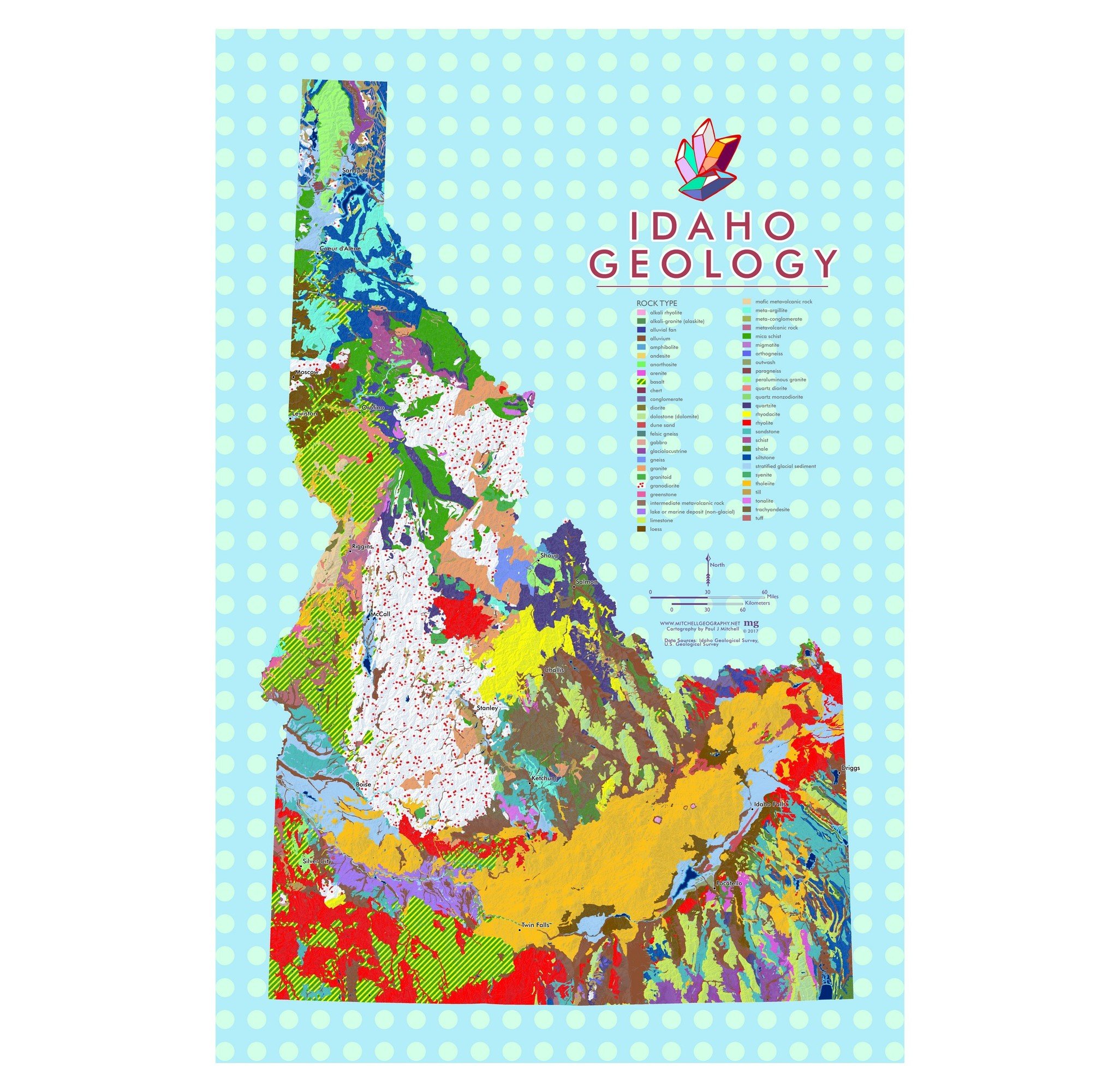
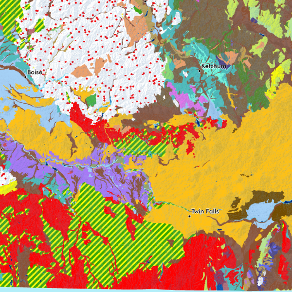
1:1,400,000
24 inch by 20 inch flat wall map, printed on heavy fine paper. Shipped rolled.
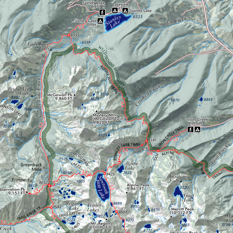
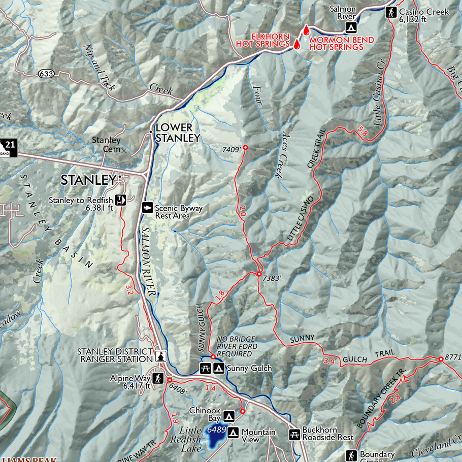
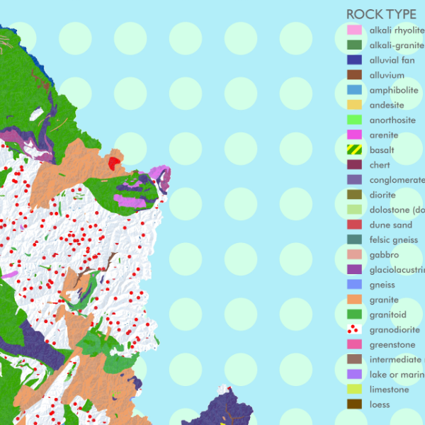
This map replaces the earlier 13 x 19 inch version, which is now out of print. Idaho is in many ways the most wild of the lower 48 continental states. Not only is the Frank Church/Selway-Bitterroot/Gospel Hump the largest federal contiguous designated wilderness complex in the continental 48 states, but Idaho also can boast of many more thousands of acres in wilderness, roadless, and additional conservation classifications. These include areas such as the Birds of Prey National Conservation Area, the massive lave strewn Craters of the Moon Preserve, and the much loved Sawtooth Wilderness. This map highlights the wildlands of Idaho and symbolizes those wildlerness, roadless, and other classifications by status and agency management.
Wilderness acreages are summarized with an inset table. Idaho’s share of Federal Wilderness system is displayed with the inset map of the lower 48 states. A fun overview elevation profile of the state Centennial Trail. Wild & Scenic Rivers such as the Middle Fork Salmon are clearly highlighted. Detailed reference labels include places, state parks, special land management categories, alpine ski areas, special sites, highways/major roads, prominent and recognized summits and landforms of significance, and familiar hot springs (i.e. not all your secret hot springs, just the common ones ;-) ).
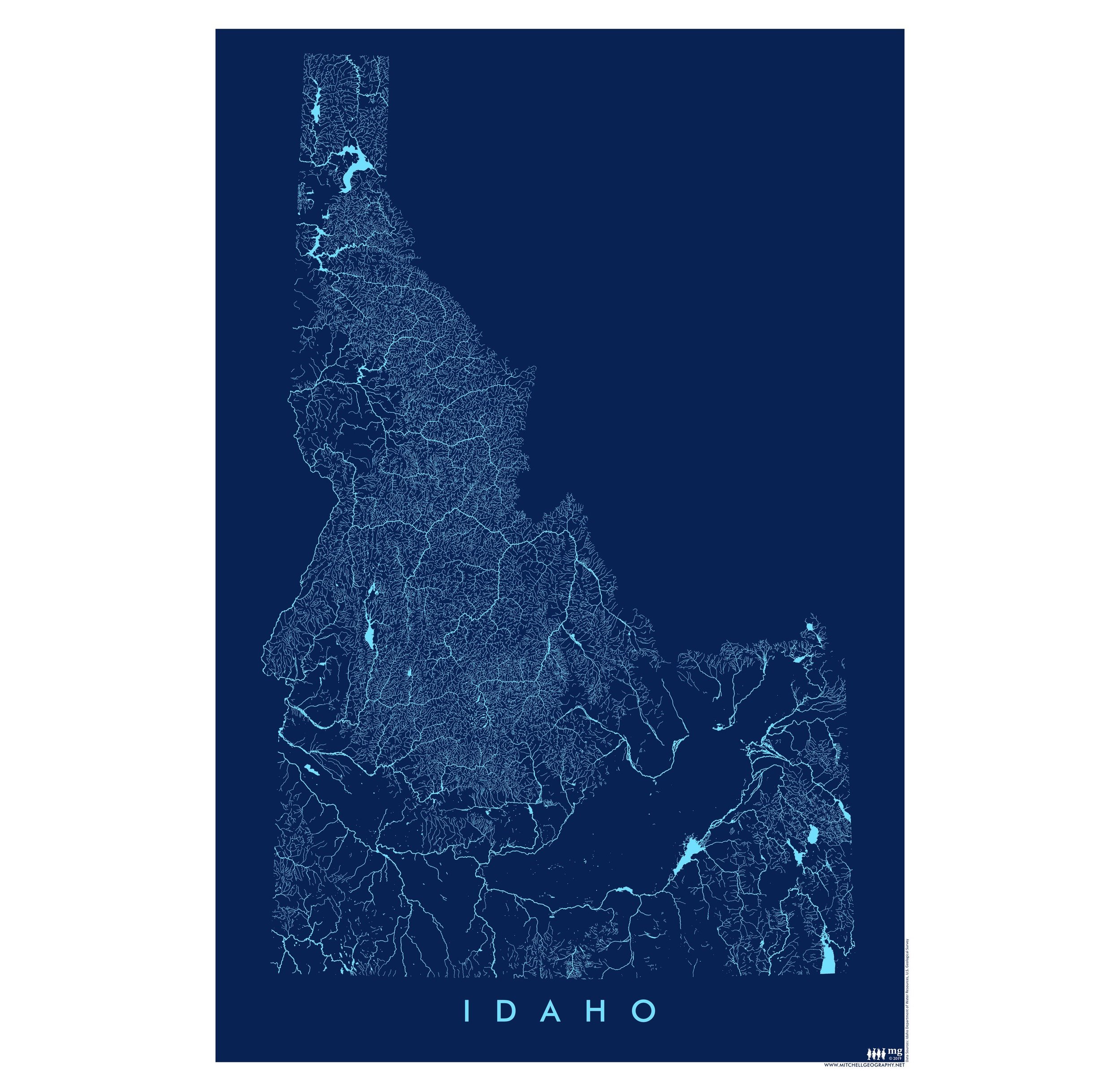
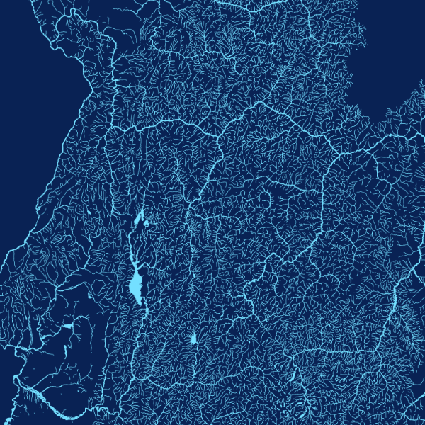
1:1,400,000
24 inch by 20 inch flat wall map, printed on heavy fine paper. Shipped rolled.
This map replaces the earlier 13 x 19 inch version, which is now out of print. Idaho is in many ways the most wild of the lower 48 continental states. Not only is the Frank Church/Selway-Bitterroot/Gospel Hump the largest federal contiguous designated wilderness complex in the continental 48 states, but Idaho also can boast of many more thousands of acres in wilderness, roadless, and additional conservation classifications. These include areas such as the Birds of Prey National Conservation Area, the massive lave strewn Craters of the Moon Preserve, and the much loved Sawtooth Wilderness. This map highlights the wildlands of Idaho and symbolizes those wildlerness, roadless, and other classifications by status and agency management.
Wilderness acreages are summarized with an inset table. Idaho’s share of Federal Wilderness system is displayed with the inset map of the lower 48 states. A fun overview elevation profile of the state Centennial Trail. Wild & Scenic Rivers such as the Middle Fork Salmon are clearly highlighted. Detailed reference labels include places, state parks, special land management categories, alpine ski areas, special sites, highways/major roads, prominent and recognized summits and landforms of significance, and familiar hot springs (i.e. not all your secret hot springs, just the common ones ;-) ).

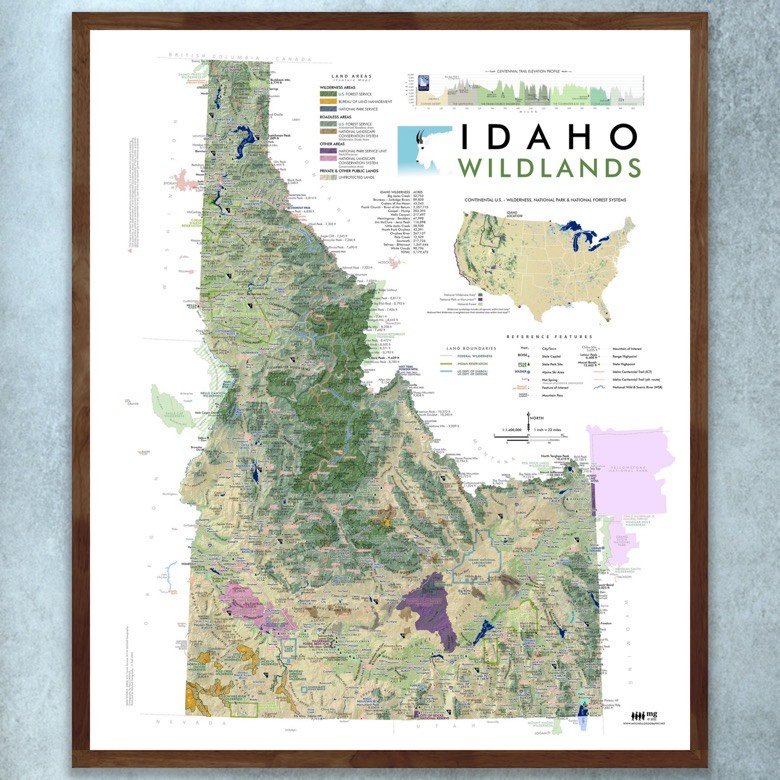 Image 1 of 11
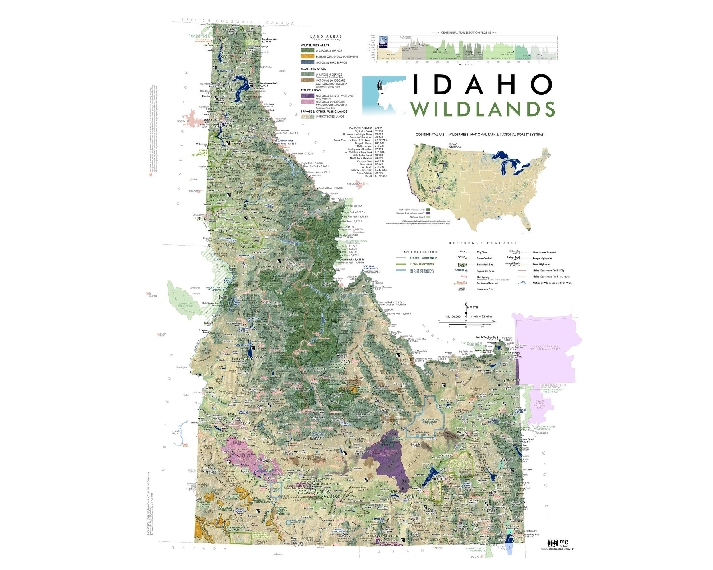 Image 2 of 11
 Image 3 of 11
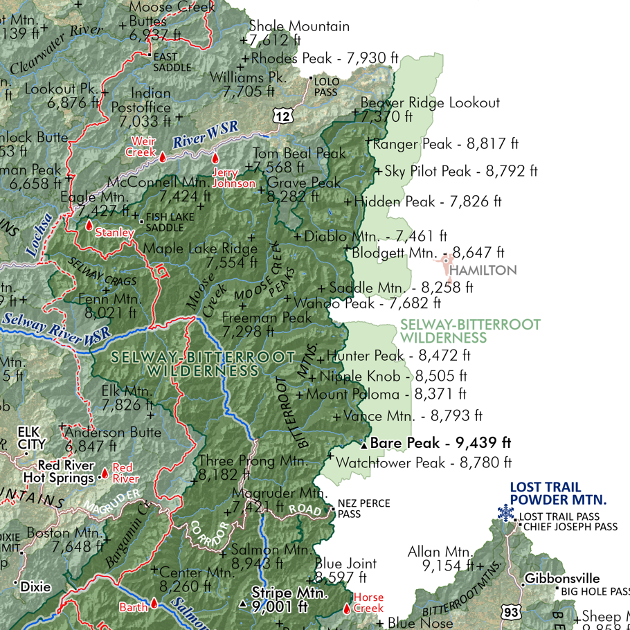 Image 4 of 11
 Image 5 of 11
 Image 6 of 11
 Image 7 of 11
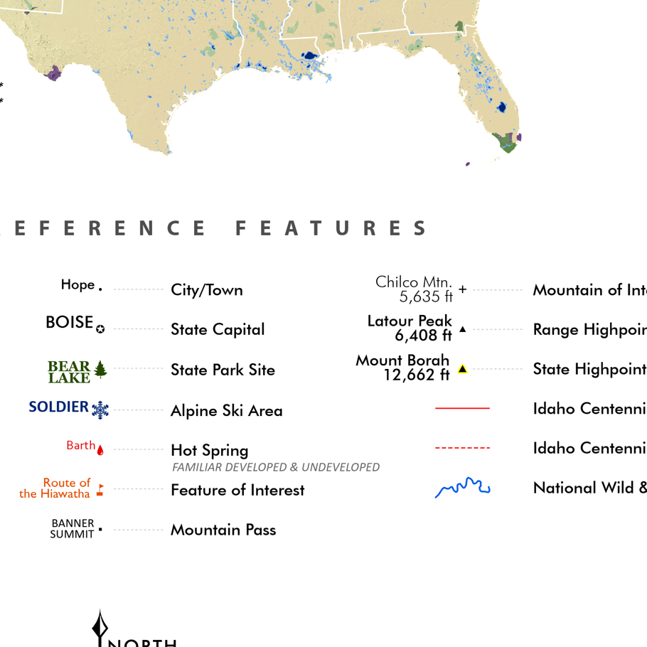 Image 8 of 11
 Image 9 of 11
 Image 10 of 11
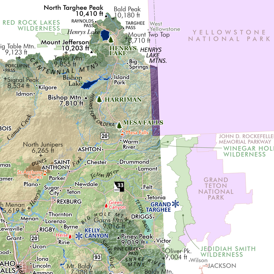 Image 11 of 11