1:75,000
13 inch by 19 inch flat wall map, printed on heavy fine paper. Packed and shipped flat.
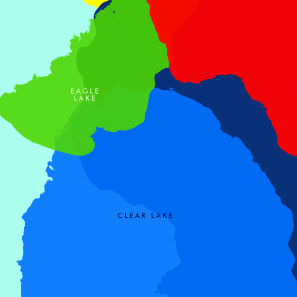
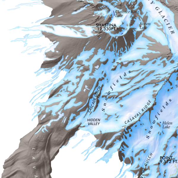
Mount Shasta, California. An artistic rendering of Mount Shasta, the grand Cascade volcano and very special 14,162 ft high point of Northern California. Map features popular U.S. Forest Service trails and trailheads, prominent lava flows delineated, detailed seasonal snow fields, labeled glaciers, the Mt. Shasta Ski Park slopes and chairlifts, and many sub-peaks and neighboring volcanic plugs and cones such as the distinct Black Butte.
1:75,000
13 inch by 19 inch flat wall map, printed on heavy fine paper. Packed and shipped flat.
Mount Shasta, California. An artistic rendering of Mount Shasta, the grand Cascade volcano and very special 14,162 ft high point of Northern California. Map features popular U.S. Forest Service trails and trailheads, prominent lava flows delineated, detailed seasonal snow fields, labeled glaciers, the Mt. Shasta Ski Park slopes and chairlifts, and many sub-peaks and neighboring volcanic plugs and cones such as the distinct Black Butte.

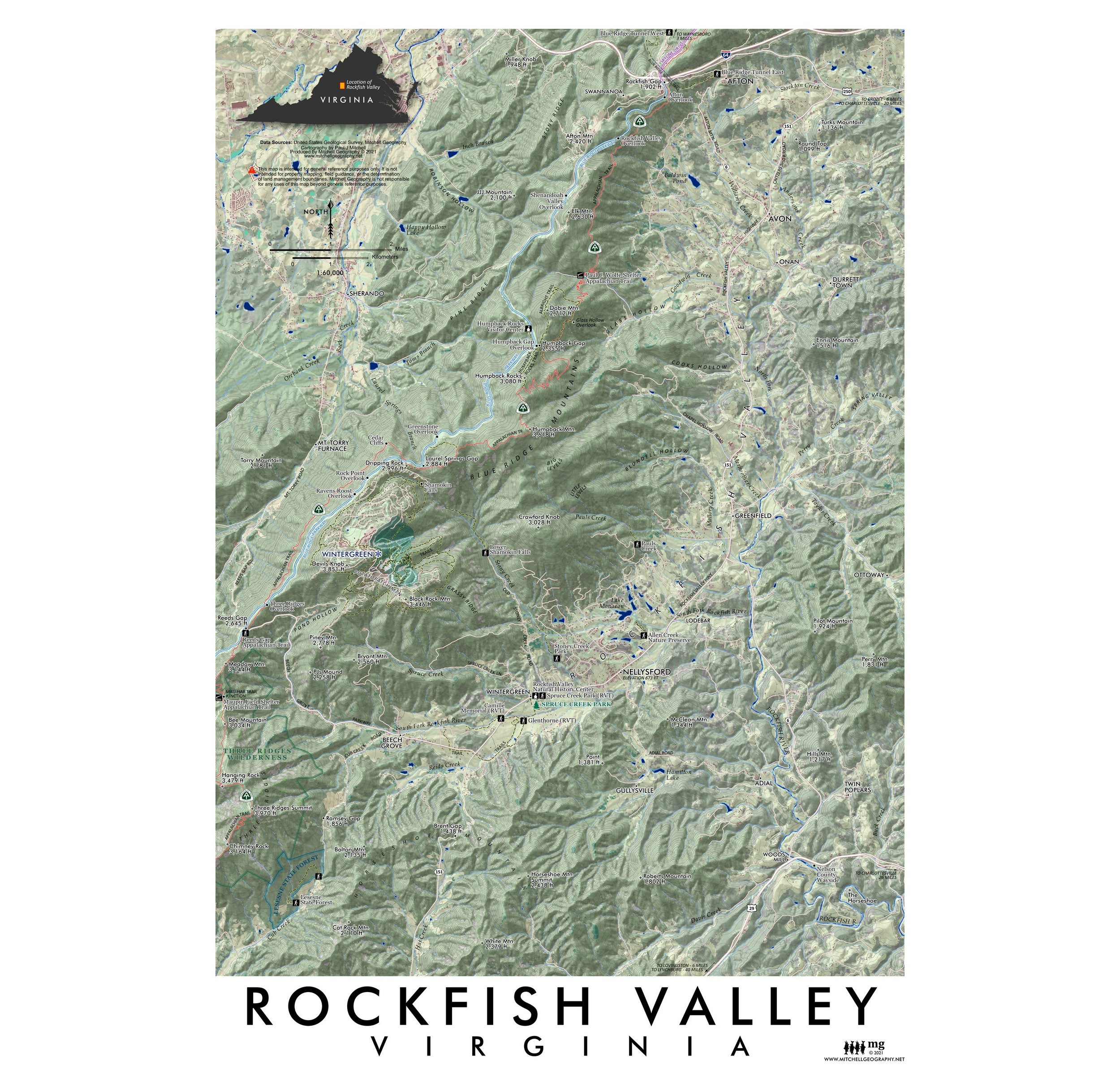
 Image 1 of 6
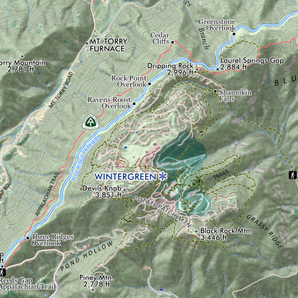
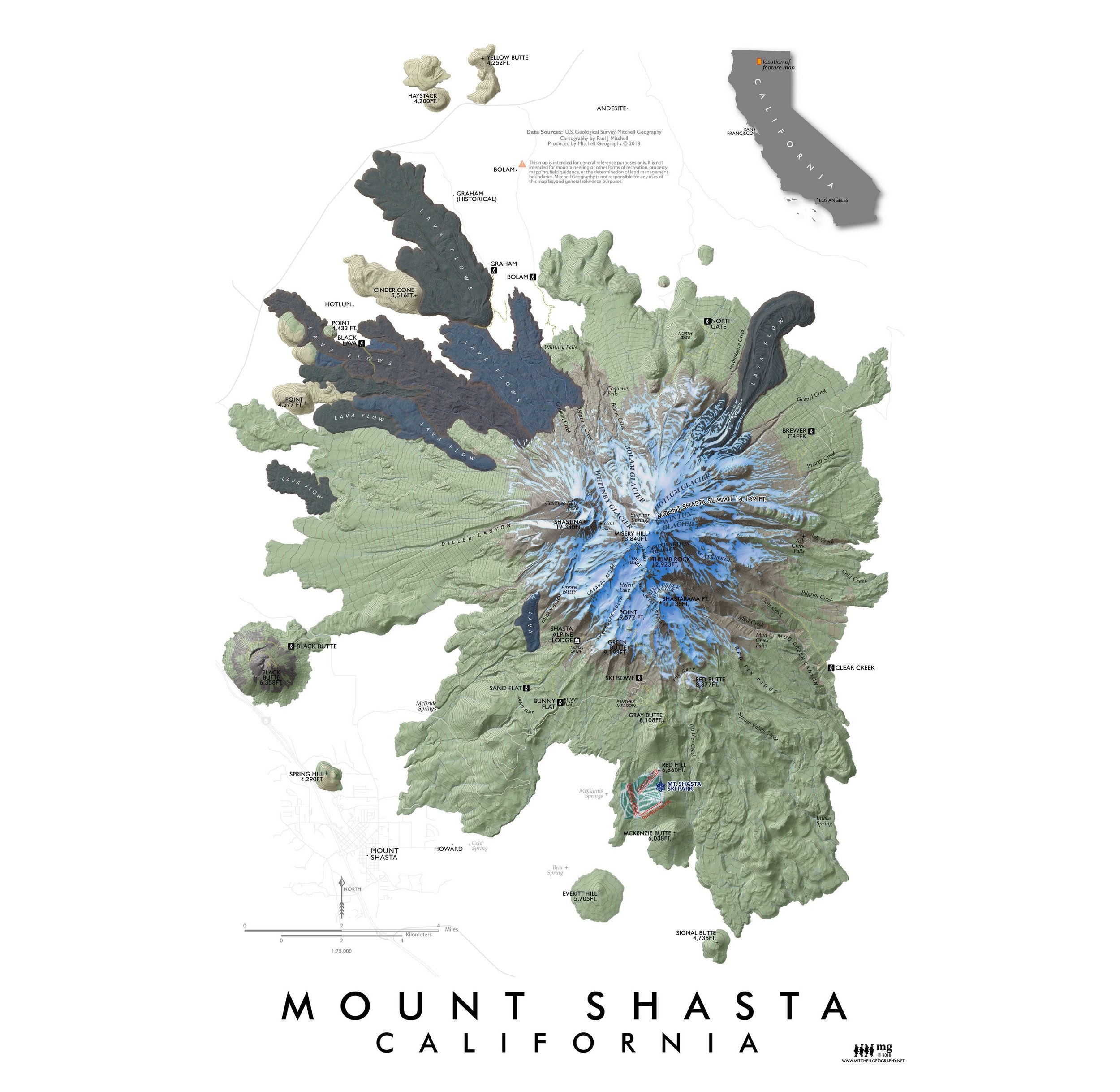 Image 2 of 6
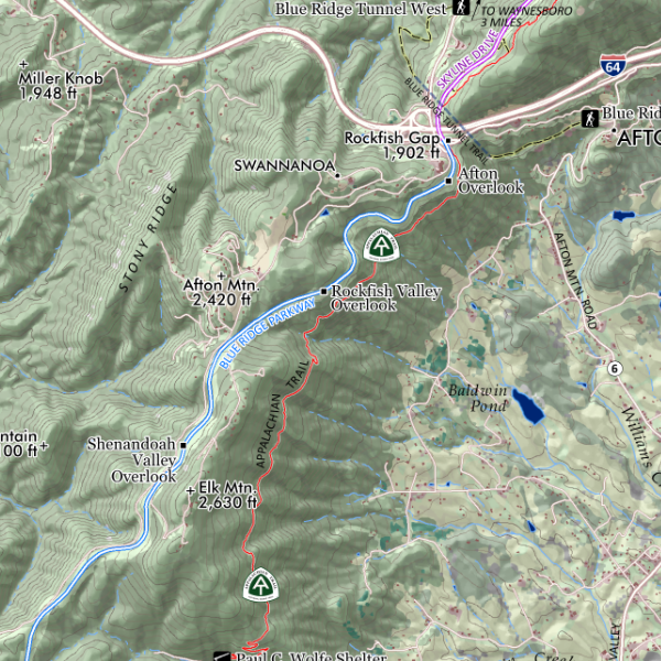
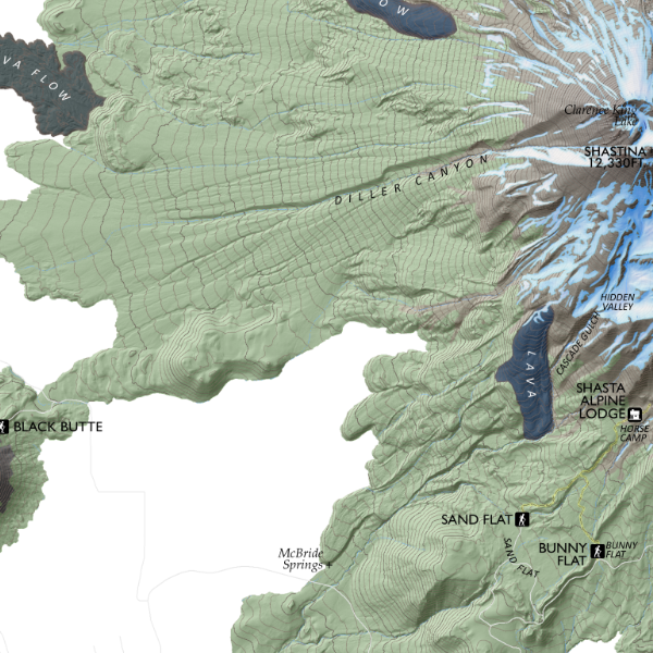 Image 3 of 6
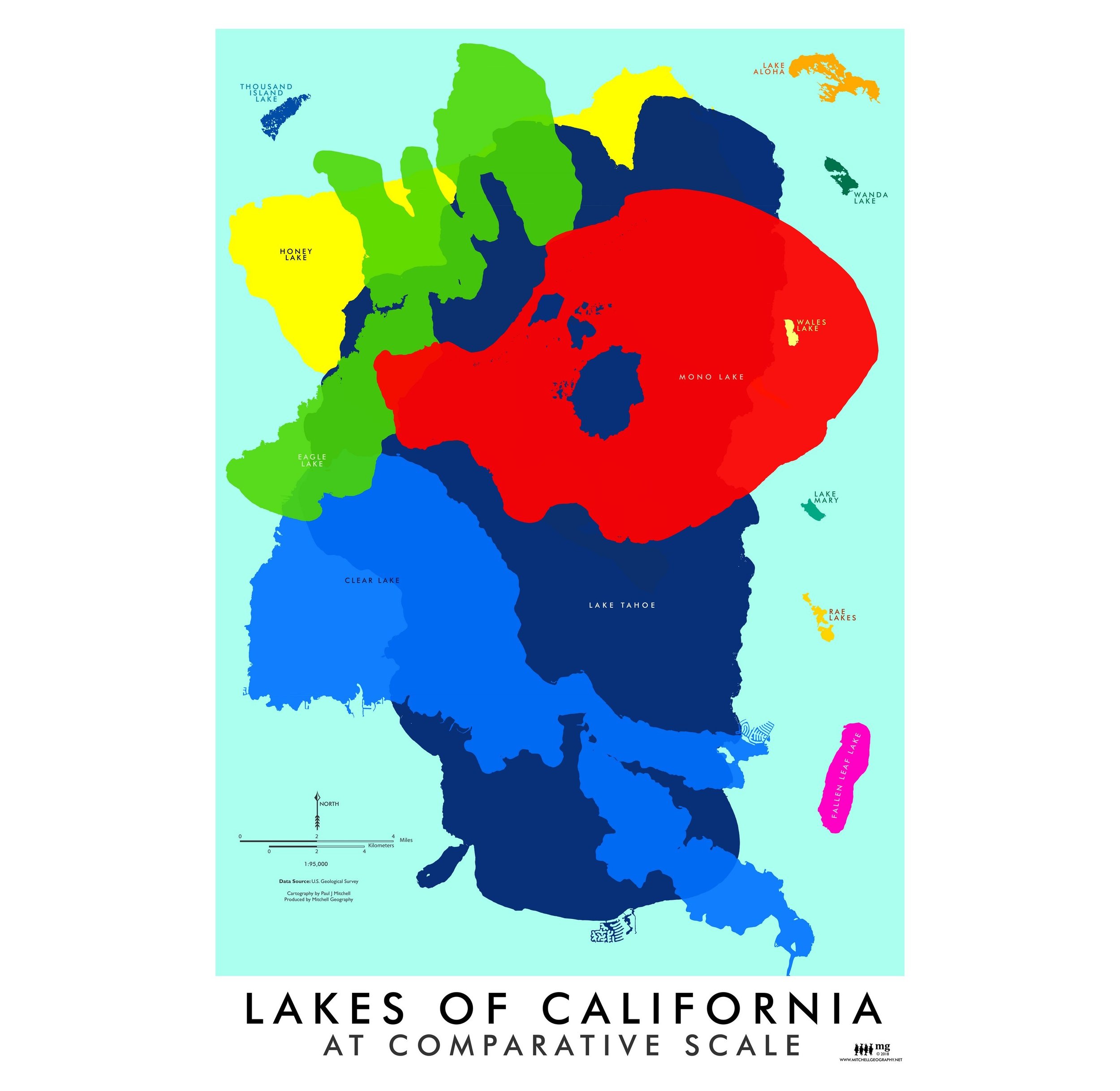
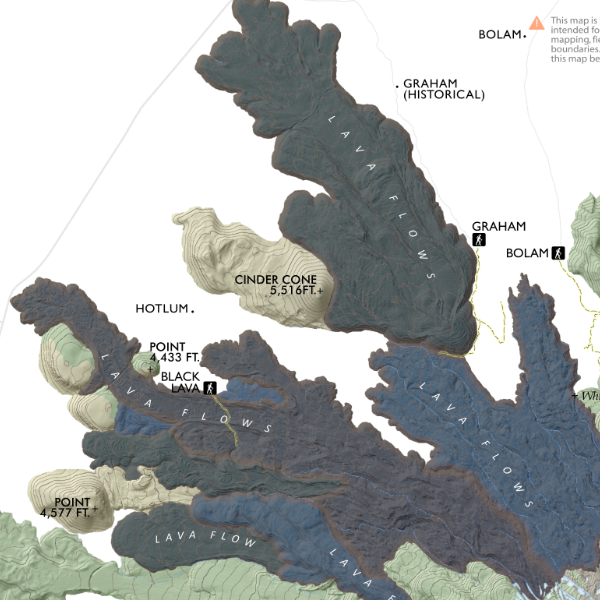 Image 4 of 6
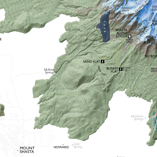 Image 5 of 6
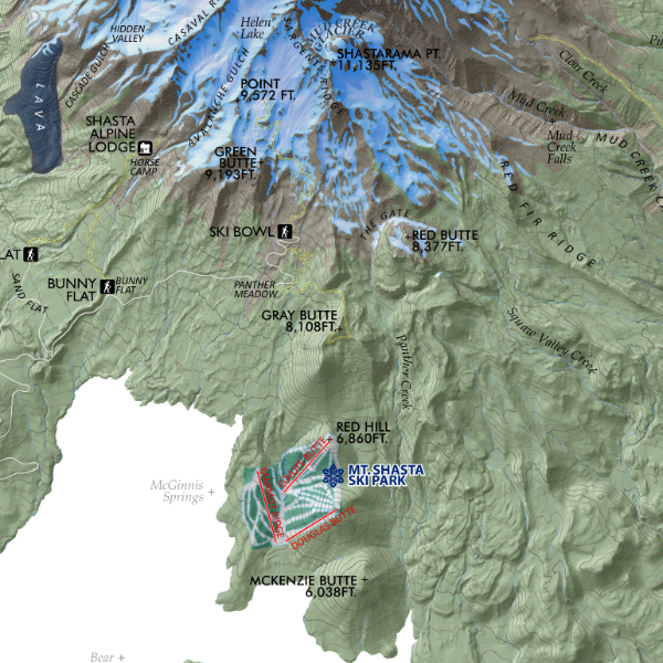 Image 6 of 6