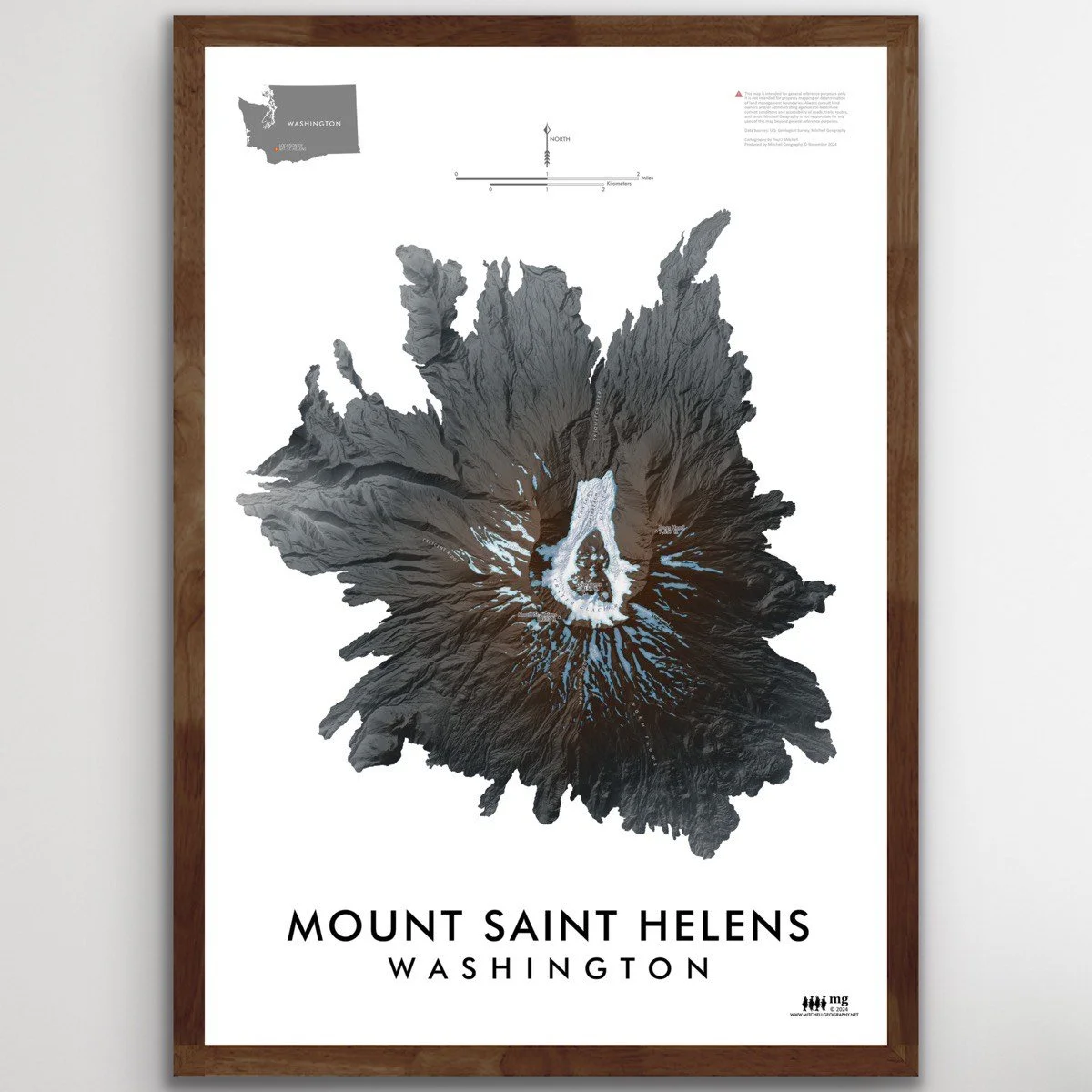


Mount Saint Helens Washington (19 in x 13 in)
13 inch by 19 inch flat wall map, printed on heavy fine paper. Packed and shipped flat.
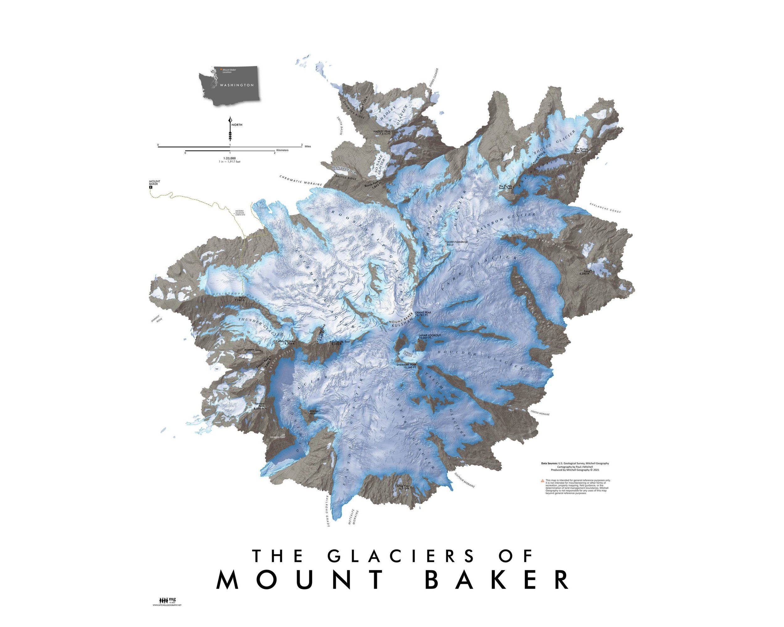
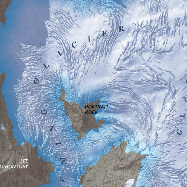
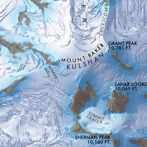
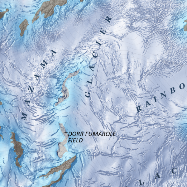
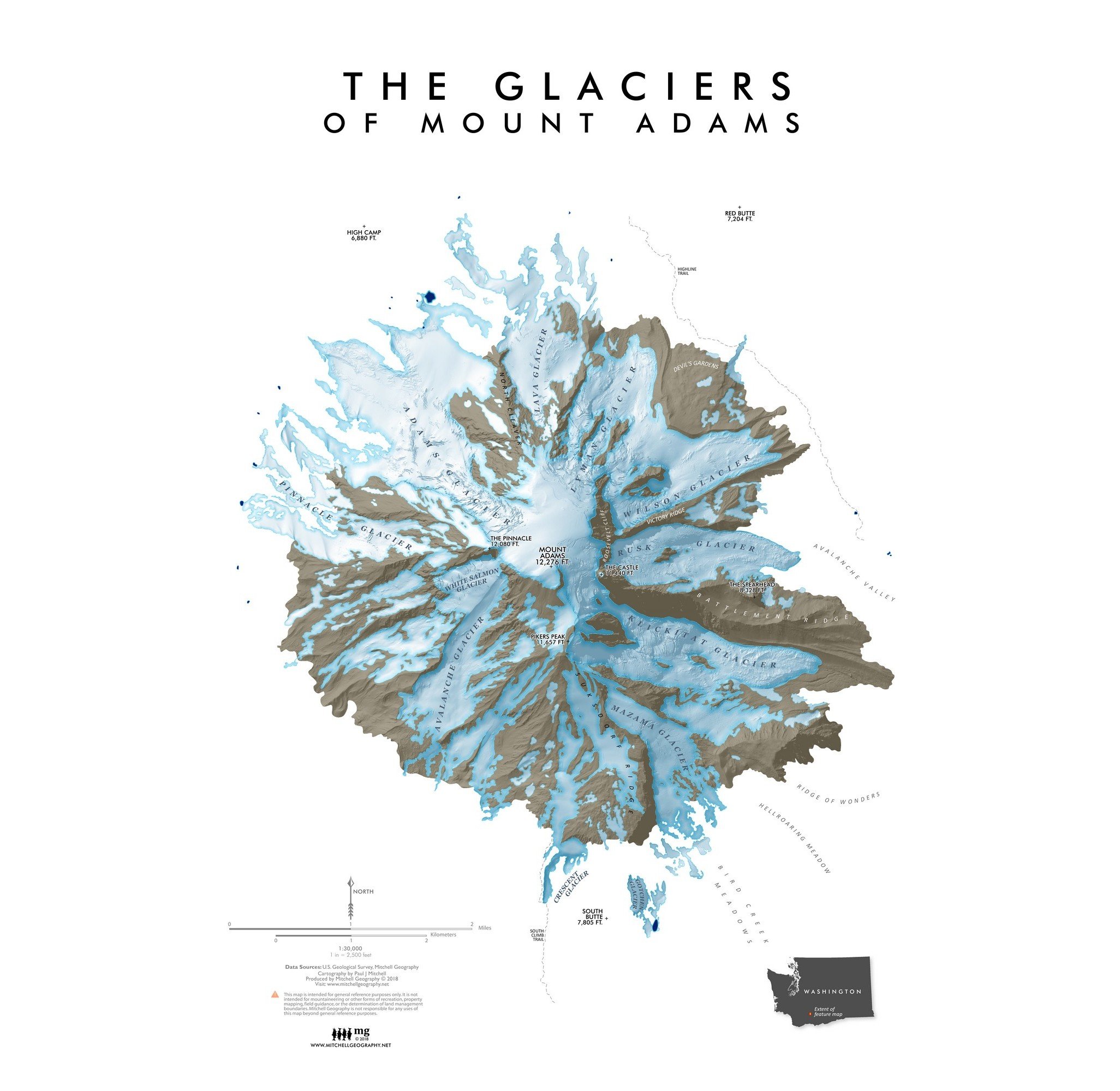
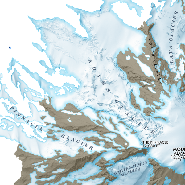
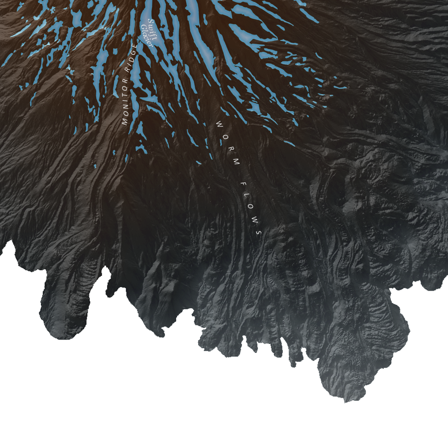
Mount Saint Helens, Washington. Richly detailed Lidar terrain map of the prominent Southwest Washington Cascade summit area. Seasonal snowfield and glacial extent derived from the Lidar dataset.
13 inch by 19 inch flat wall map, printed on heavy fine paper. Packed and shipped flat.
Mount Saint Helens, Washington. Richly detailed Lidar terrain map of the prominent Southwest Washington Cascade summit area. Seasonal snowfield and glacial extent derived from the Lidar dataset.
13 inch by 19 inch flat wall map, printed on heavy fine paper. Packed and shipped flat.
Mount Saint Helens, Washington. Richly detailed Lidar terrain map of the prominent Southwest Washington Cascade summit area. Seasonal snowfield and glacial extent derived from the Lidar dataset.