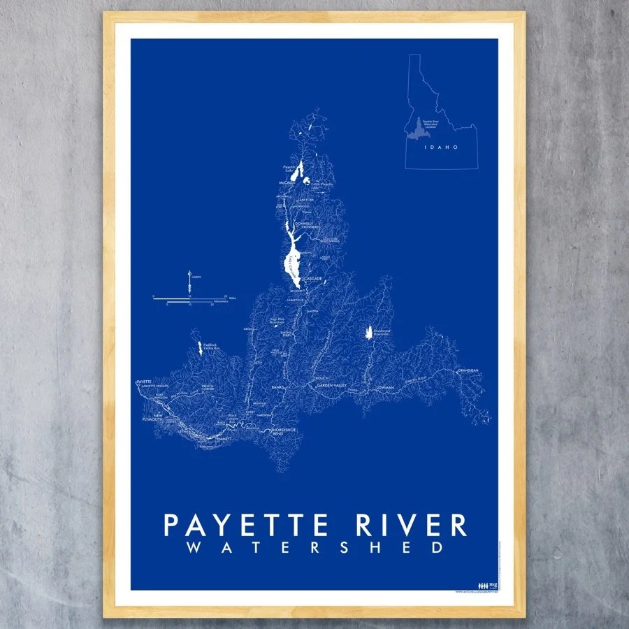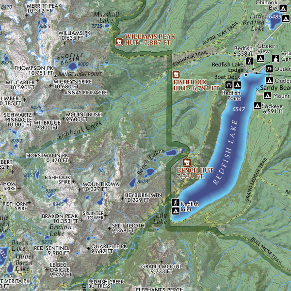
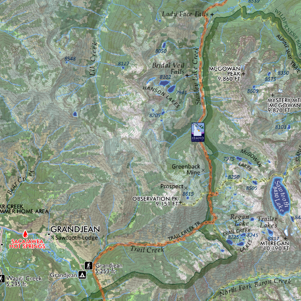

Sawtooth Wilderness Idaho (24 in x 20 in)
1:94,000 :: (1 inch = 7833 ft)
24 inch x 20 inch — flat wall map, printed on a heavy fine paper — shipped rolled.
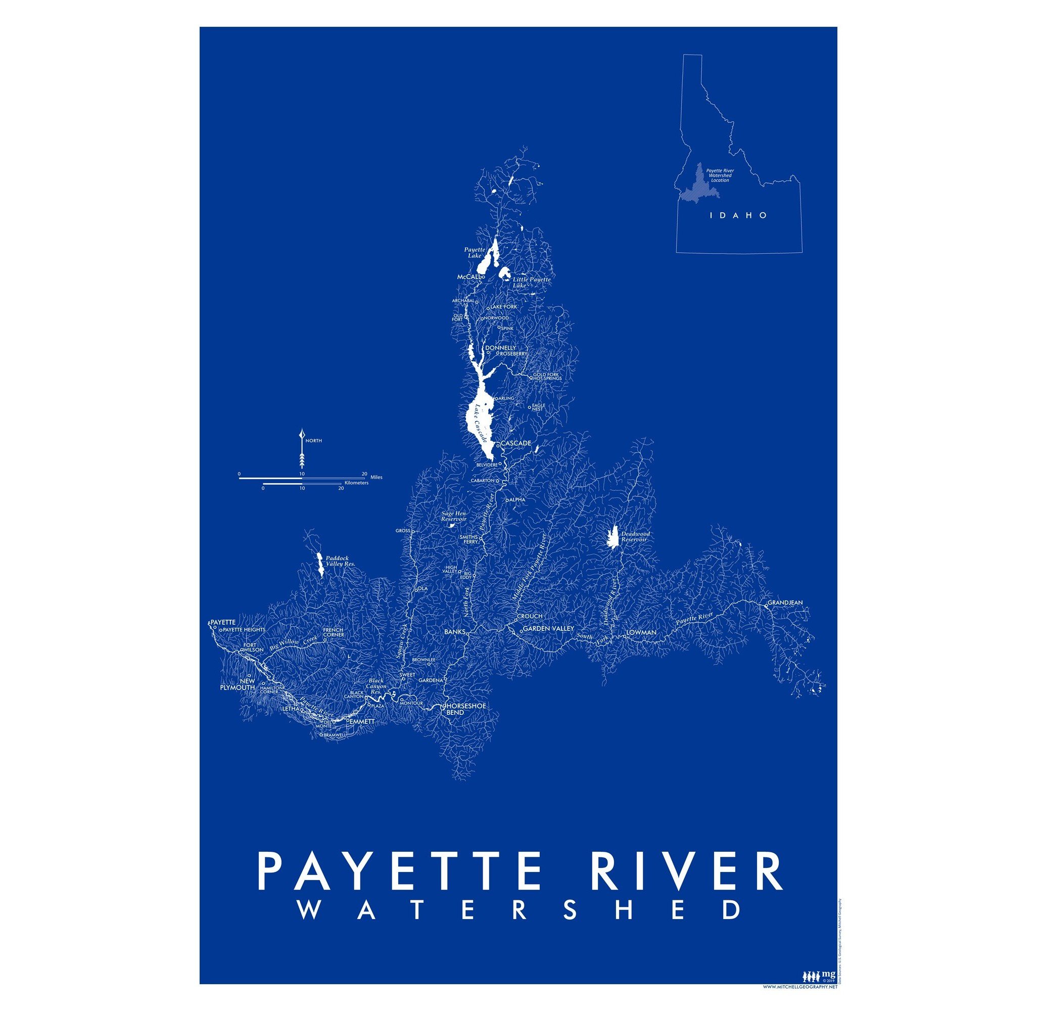
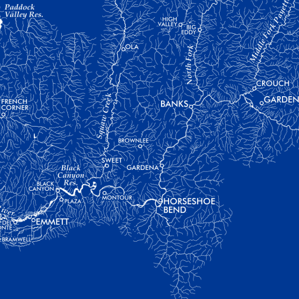
Mid-sized wall map of Idaho’s renowned Sawtooth Wilderness. Featuring official trails, USFS trailheads, the Idaho Centennial Trail (ICT) route, campgrounds, adjacent lodges, familiar non-commercial hot springs, backcountry hut/yurts (i.e. SVT and SMG), lake spot elevations in every upper basin, summit, spire, landform place names, and some of the provincial alpine names.
1:94,000 :: (1 inch = 7833 ft)
24 inch x 20 inch — flat wall map, printed on a heavy fine paper — shipped rolled.
Mid-sized wall map of Idaho’s renowned Sawtooth Wilderness. Featuring official trails, USFS trailheads, the Idaho Centennial Trail (ICT) route, campgrounds, adjacent lodges, familiar non-commercial hot springs, backcountry hut/yurts (i.e. SVT and SMG), lake spot elevations in every upper basin, summit, spire, landform place names, and some of the provincial alpine names.