TWO SIZES
• 28 inch x 20 inch flat wall map. 1:235,000 scale (i.e. more detail) Shipped tubed.
• 19 inch x 13 inch flat wall map. 1:350,000 scale (i.e. less detail). Packed and Shipped flat.
• 19 inch x 13 inch flat wall map. 1:350,000 scale COLOR YOUR OWN MAP version also available!
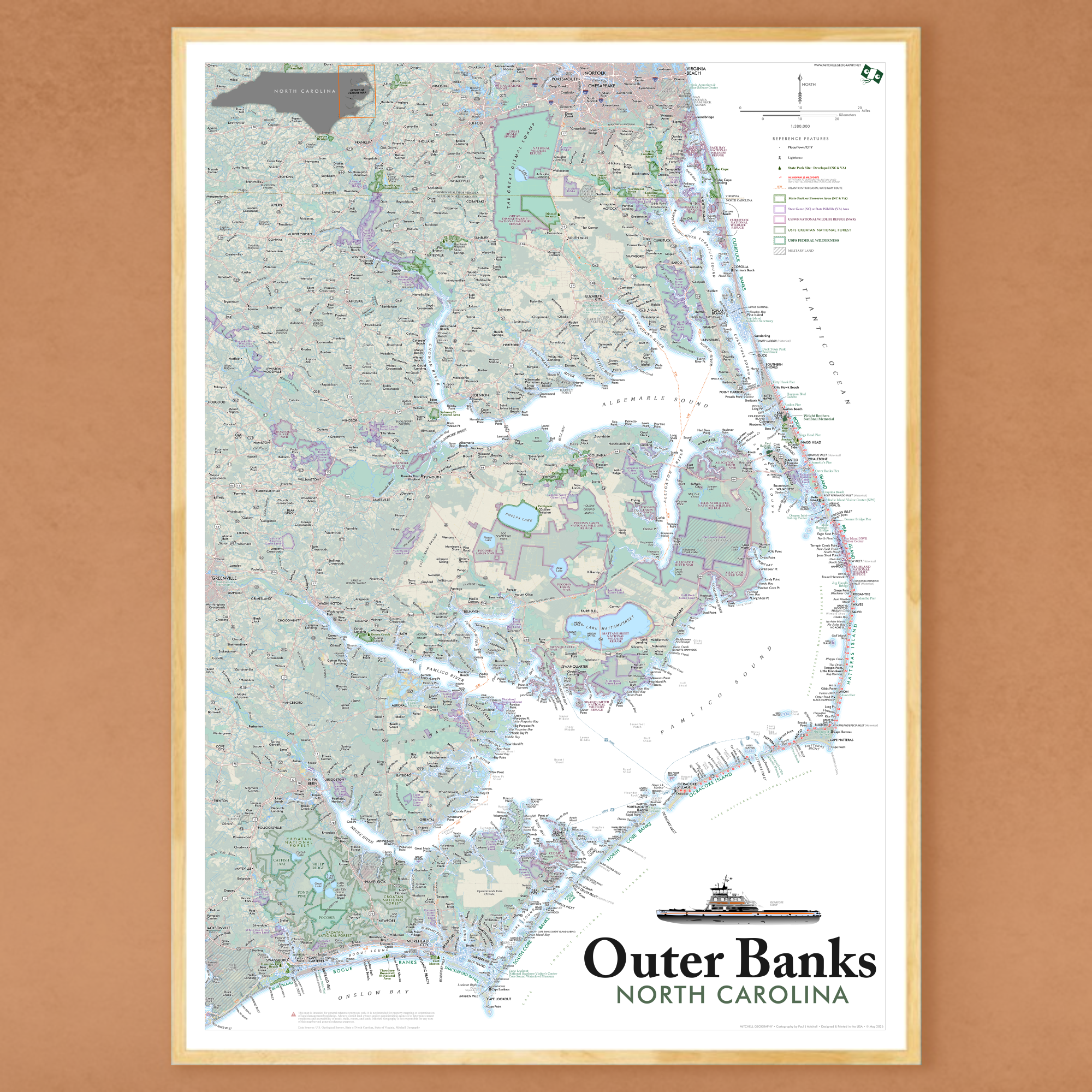
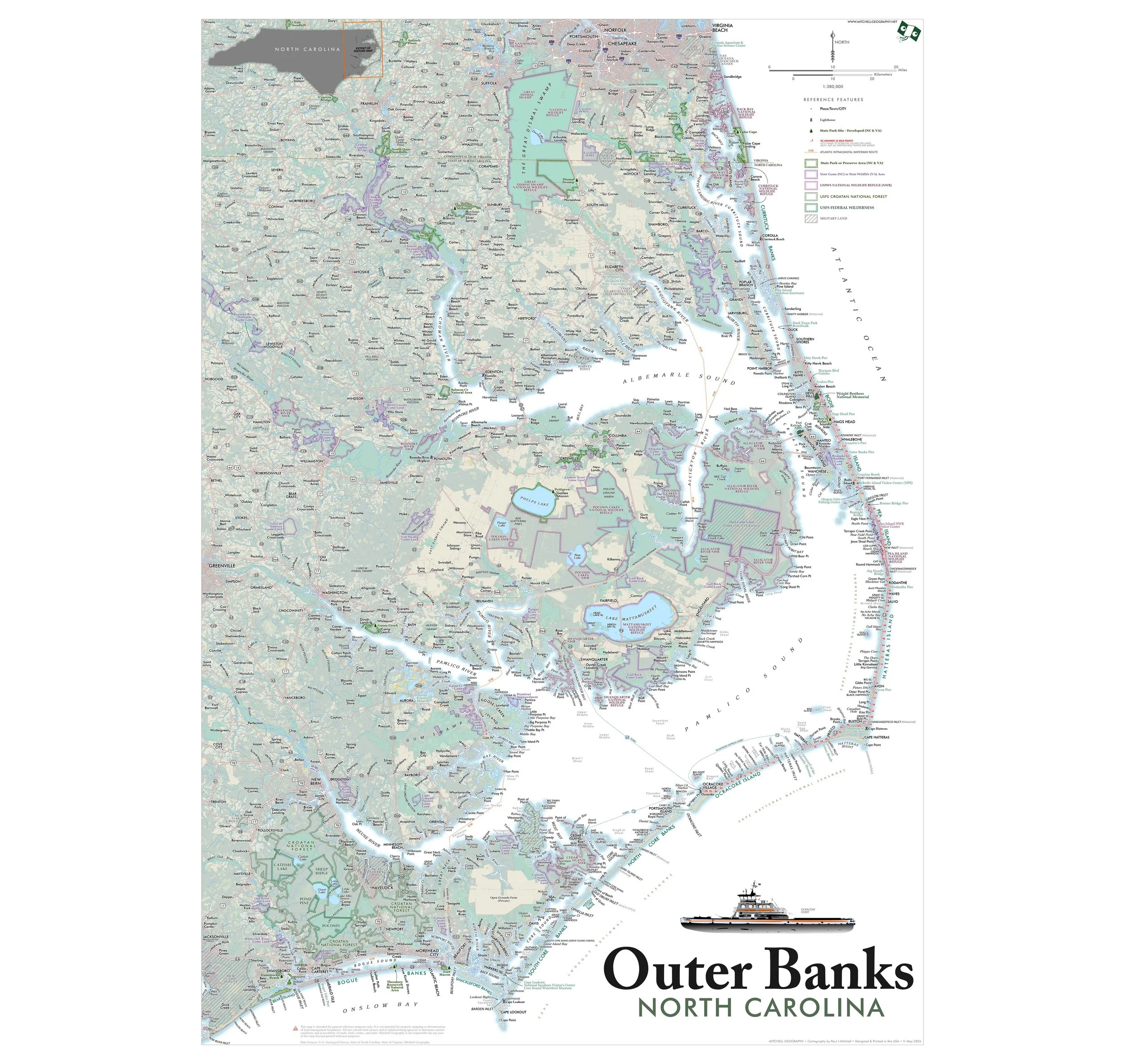
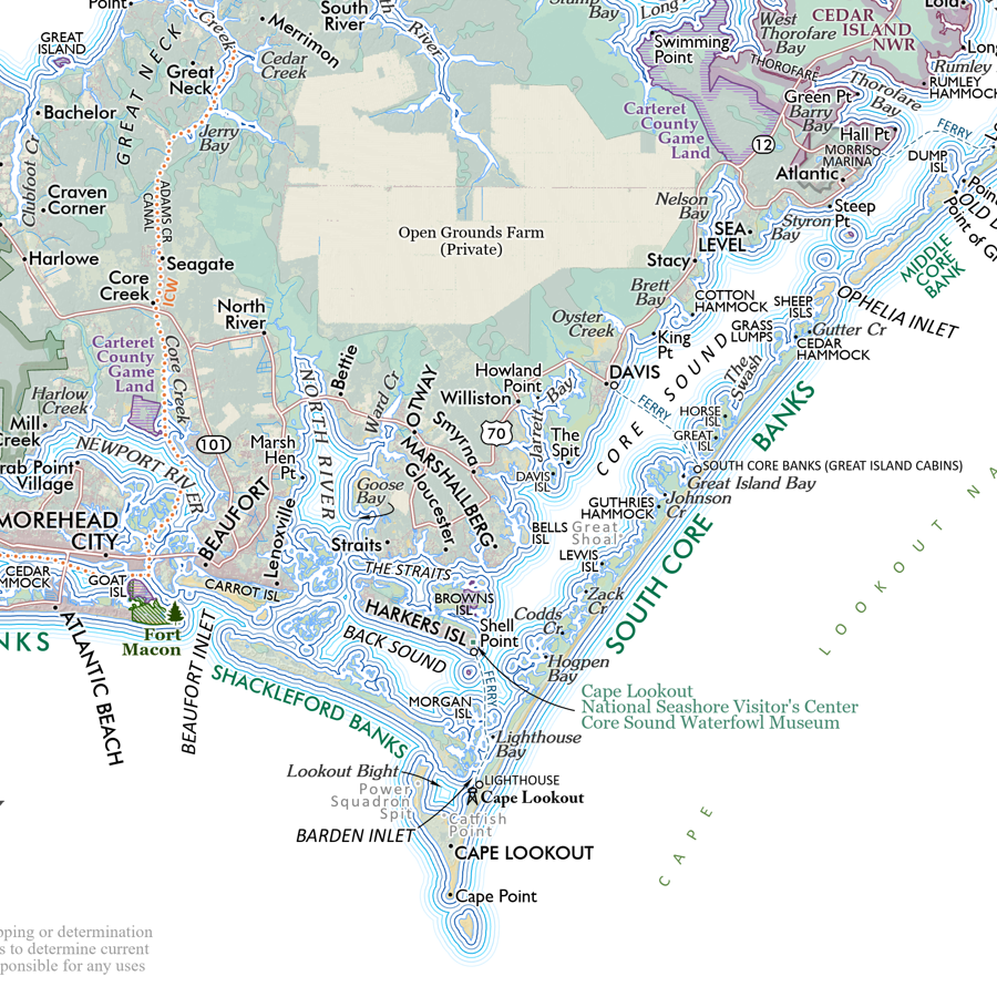
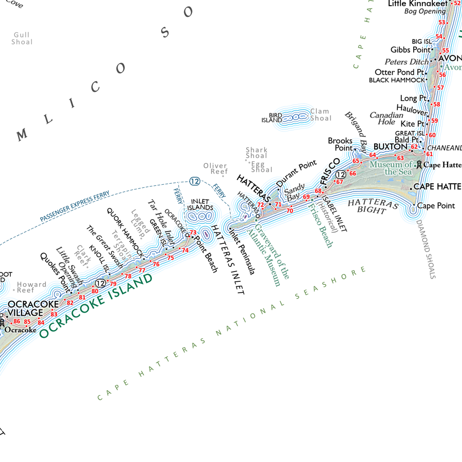
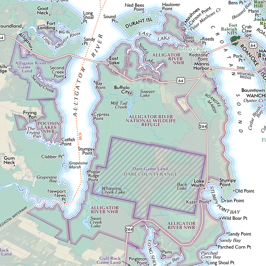
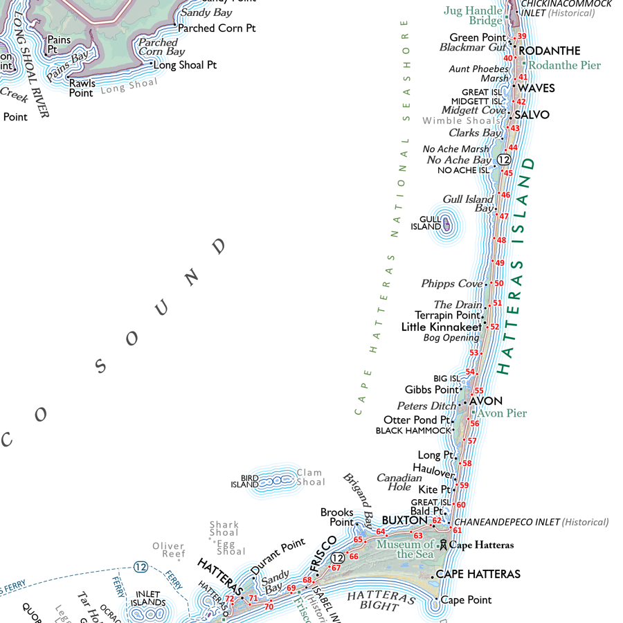
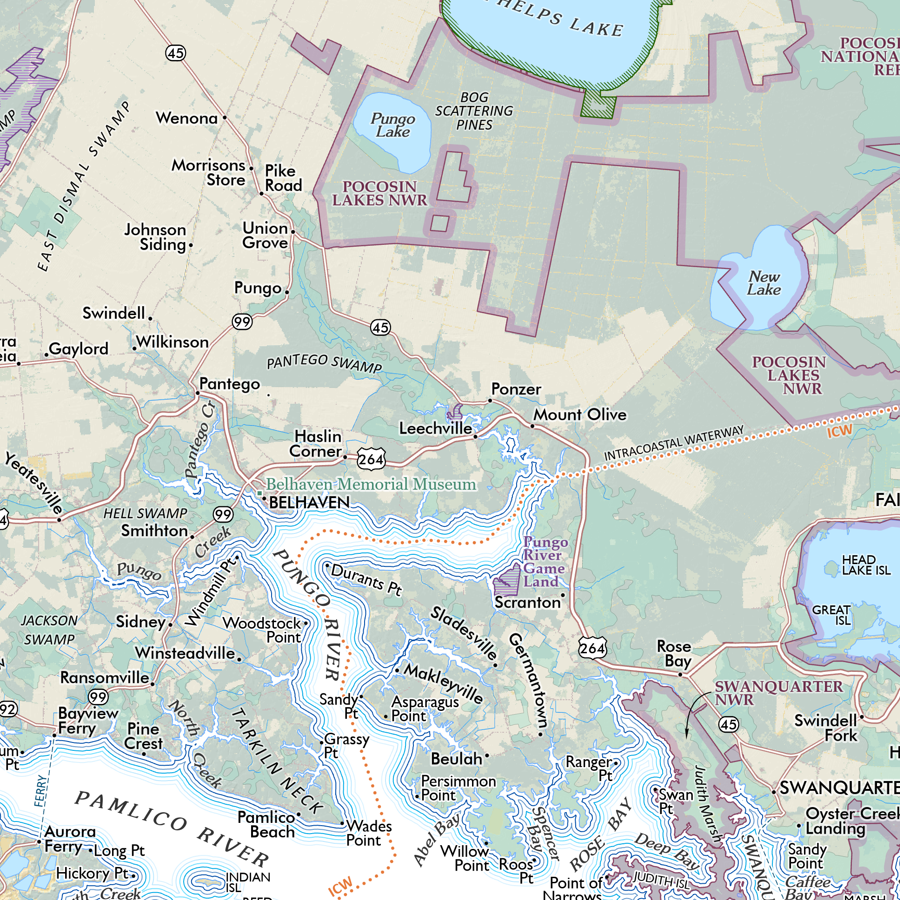
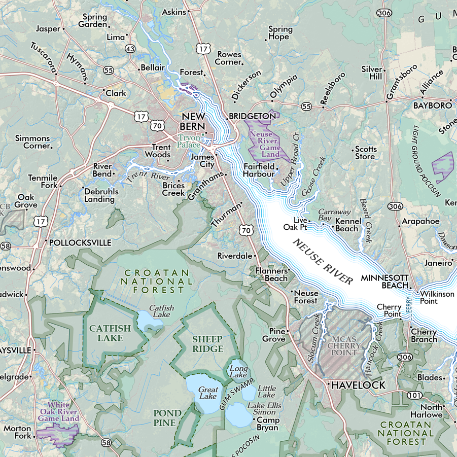
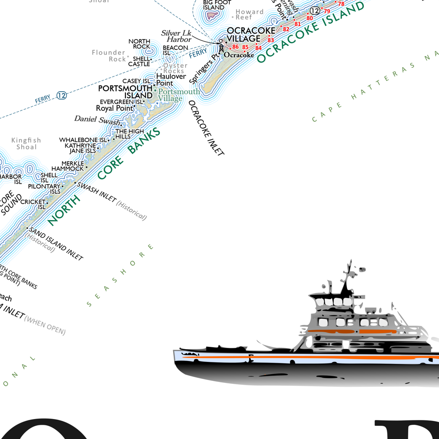
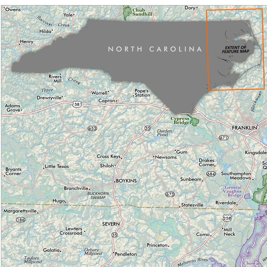
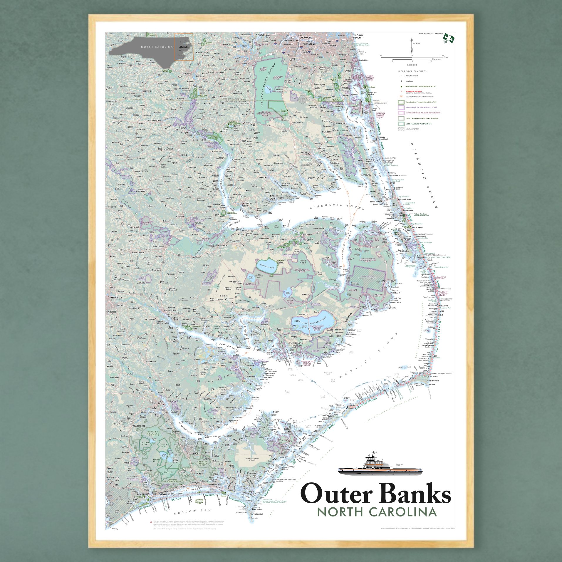
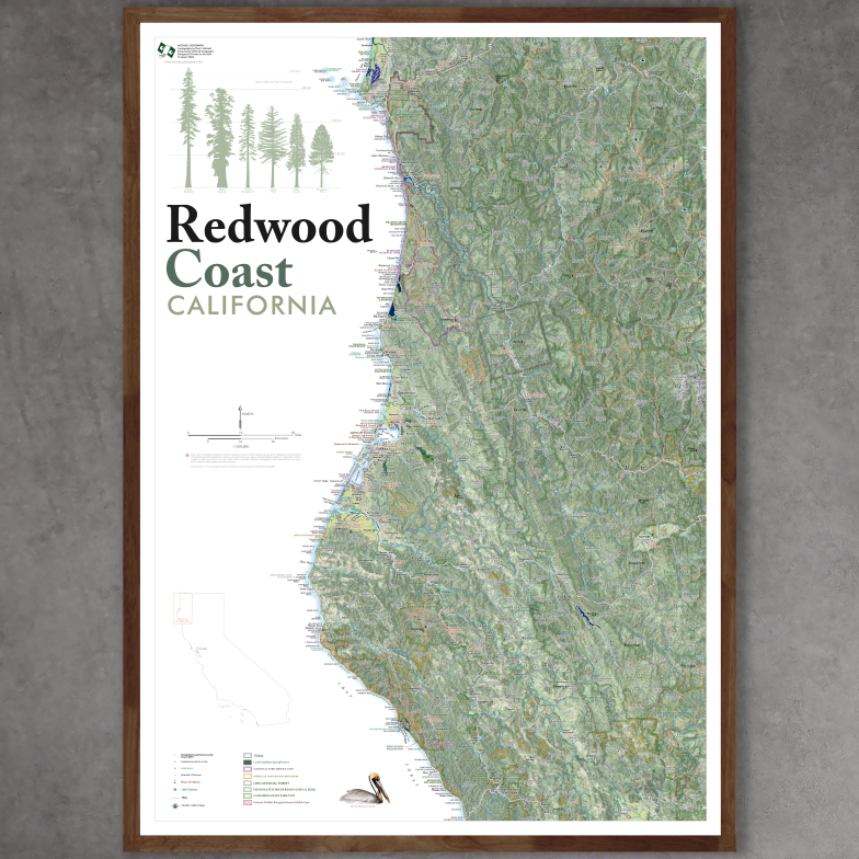
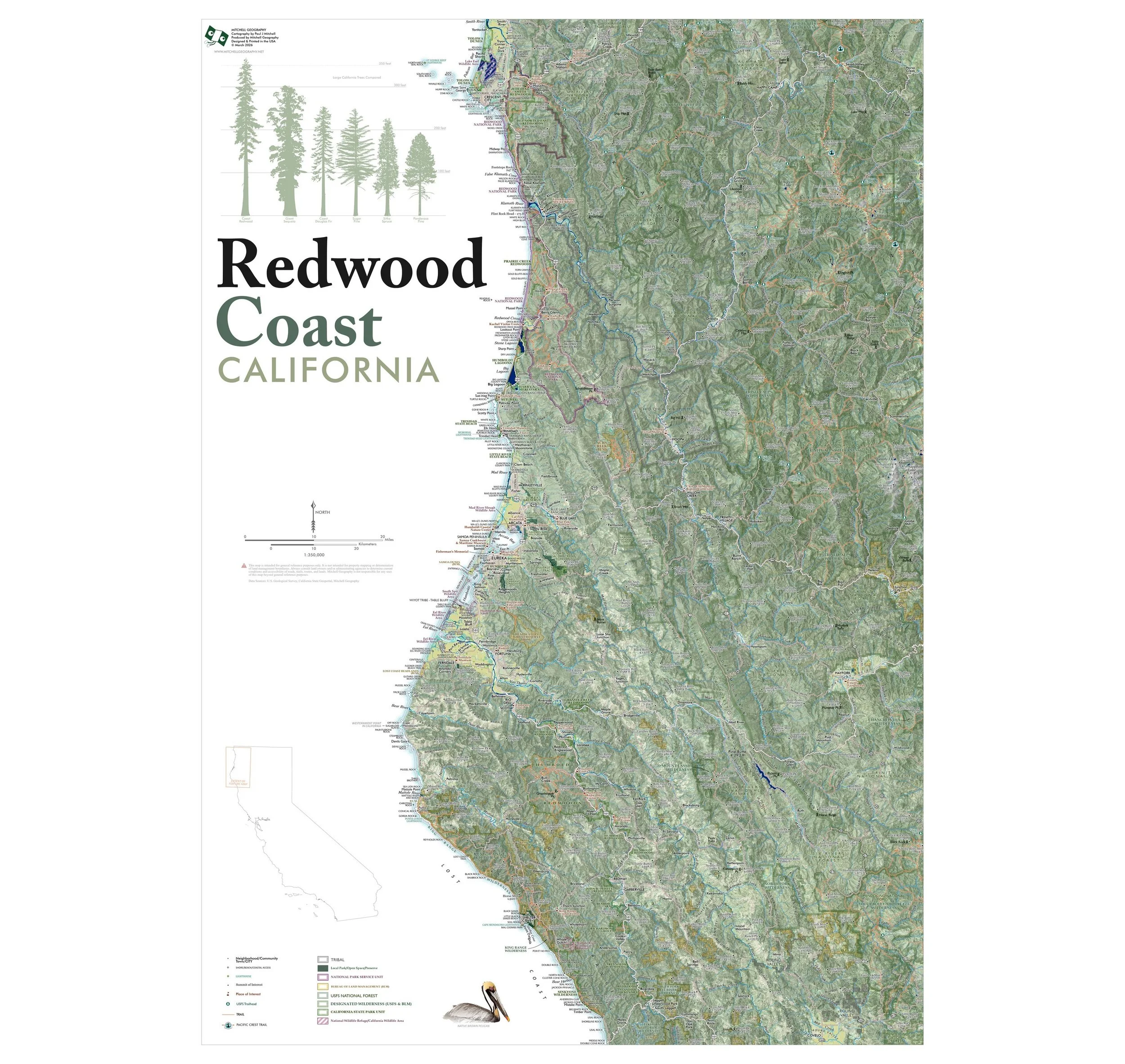
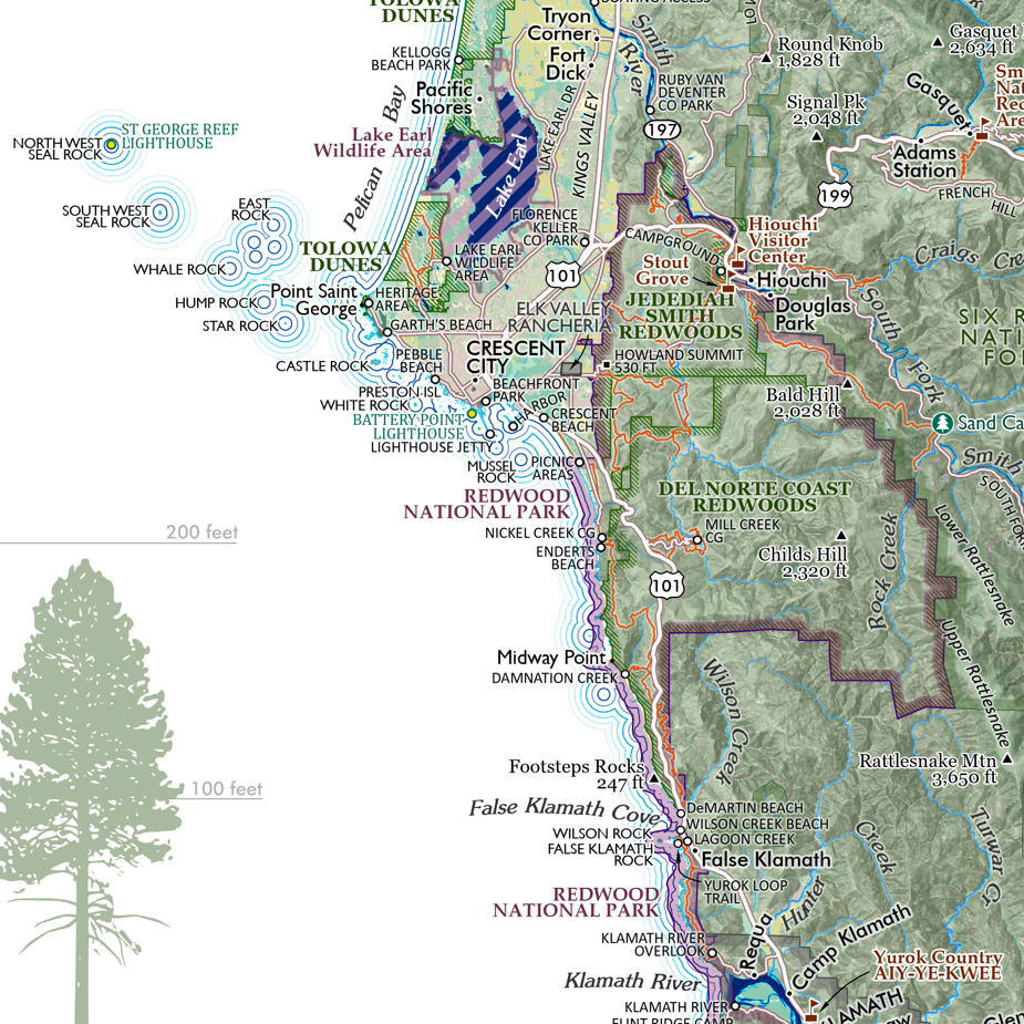
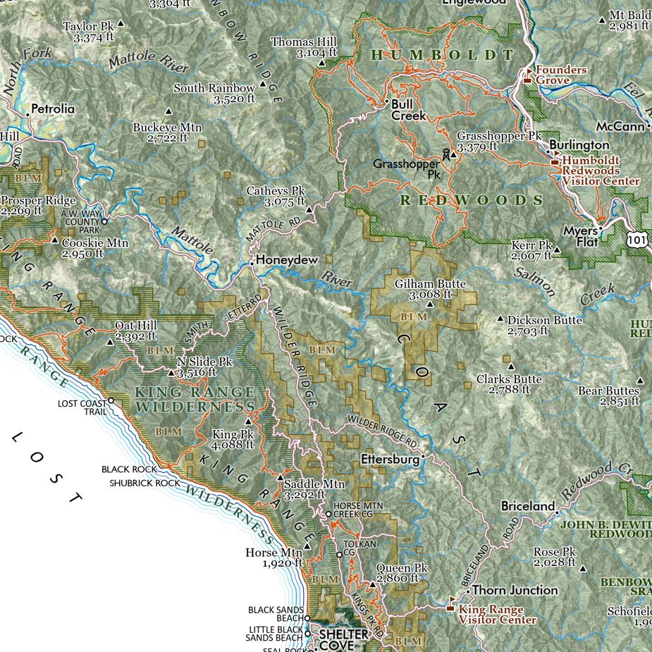
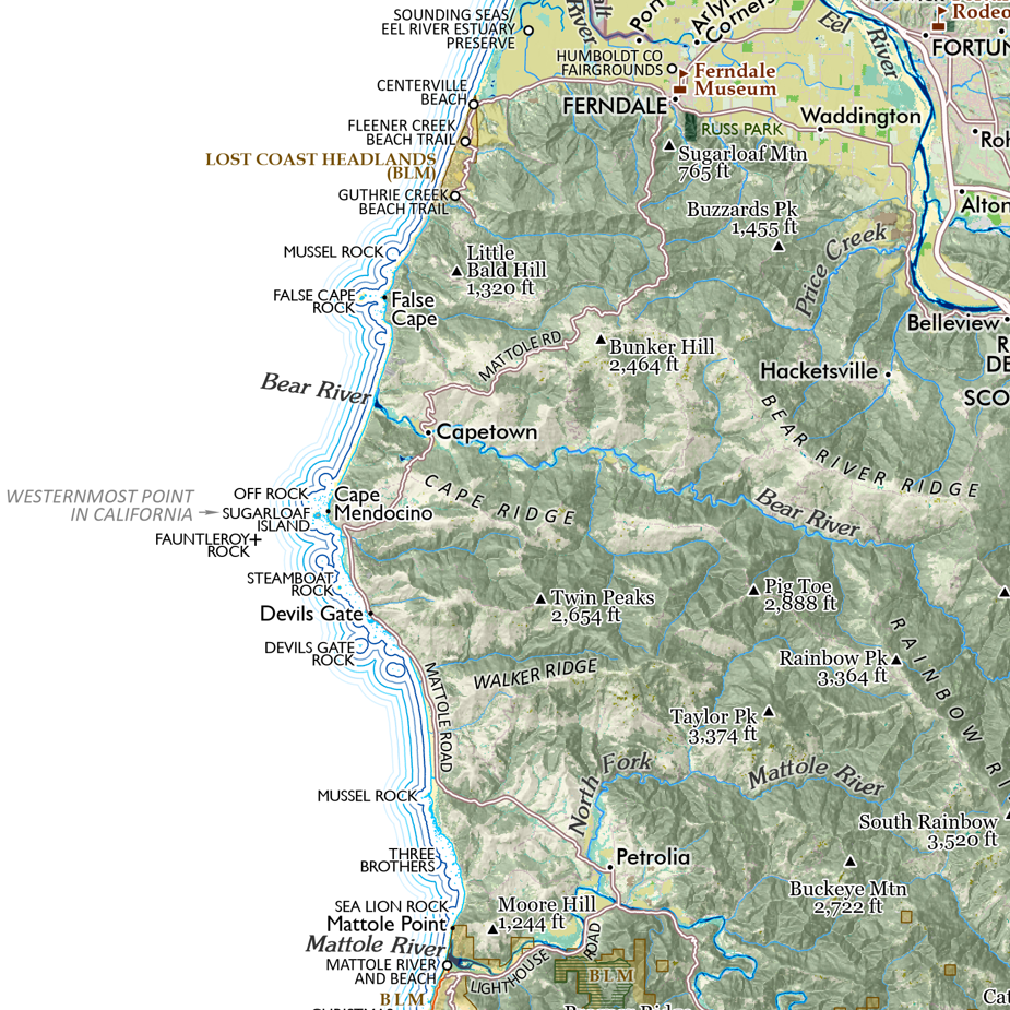
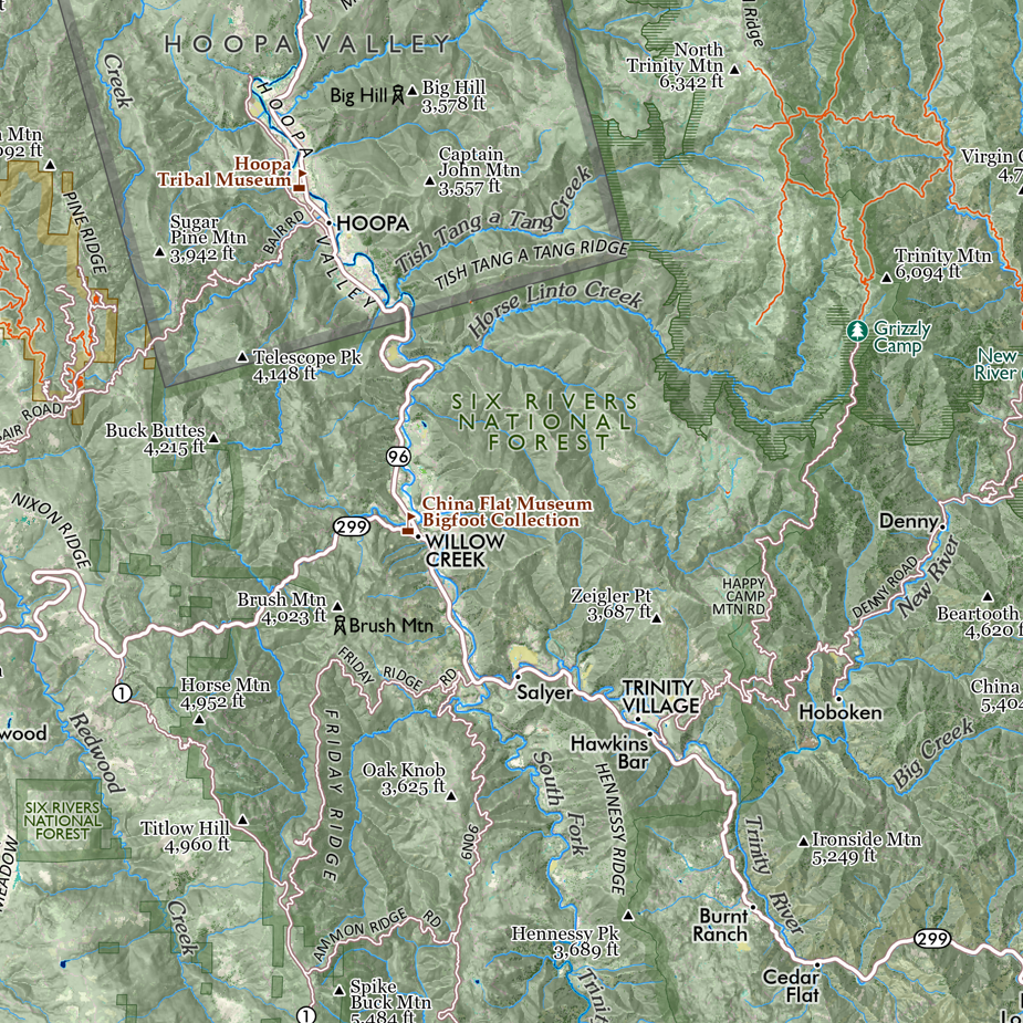
Puget Sound, Washington State. Regional overview and general reference map of the complex inlets, harbors and channels that comprise Washington State’s Puget Sound. The 28 x 20 inch version is highly detailed, the 13 x 19 version is generalized with less detail. (Please view the comparison detail image to see the difference -- all other images are of the detailed 28 x 20 inch map - TYPEFACES ARE THE SAME SIZE IN PRINT).
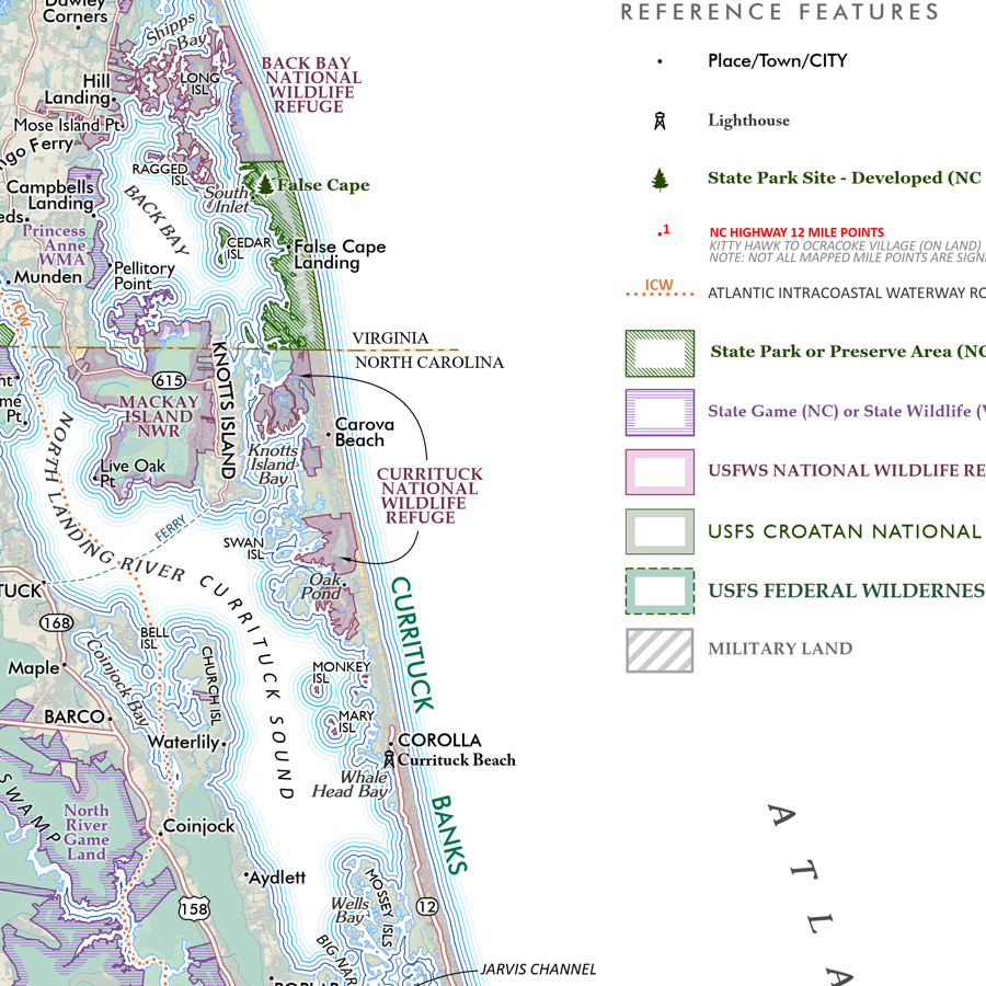
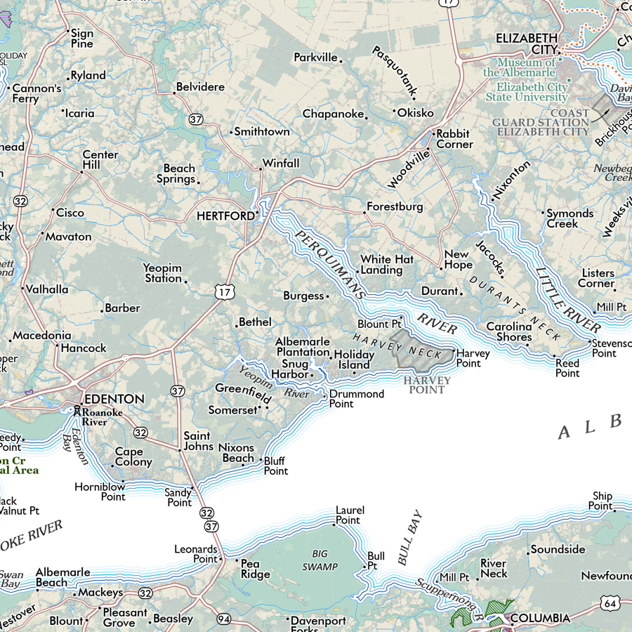
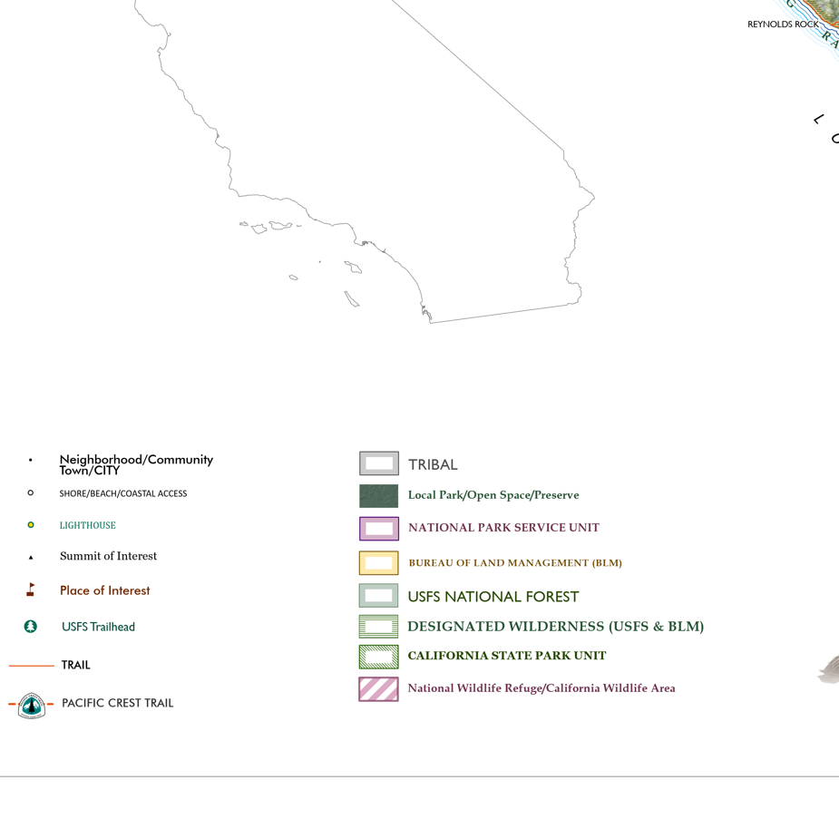
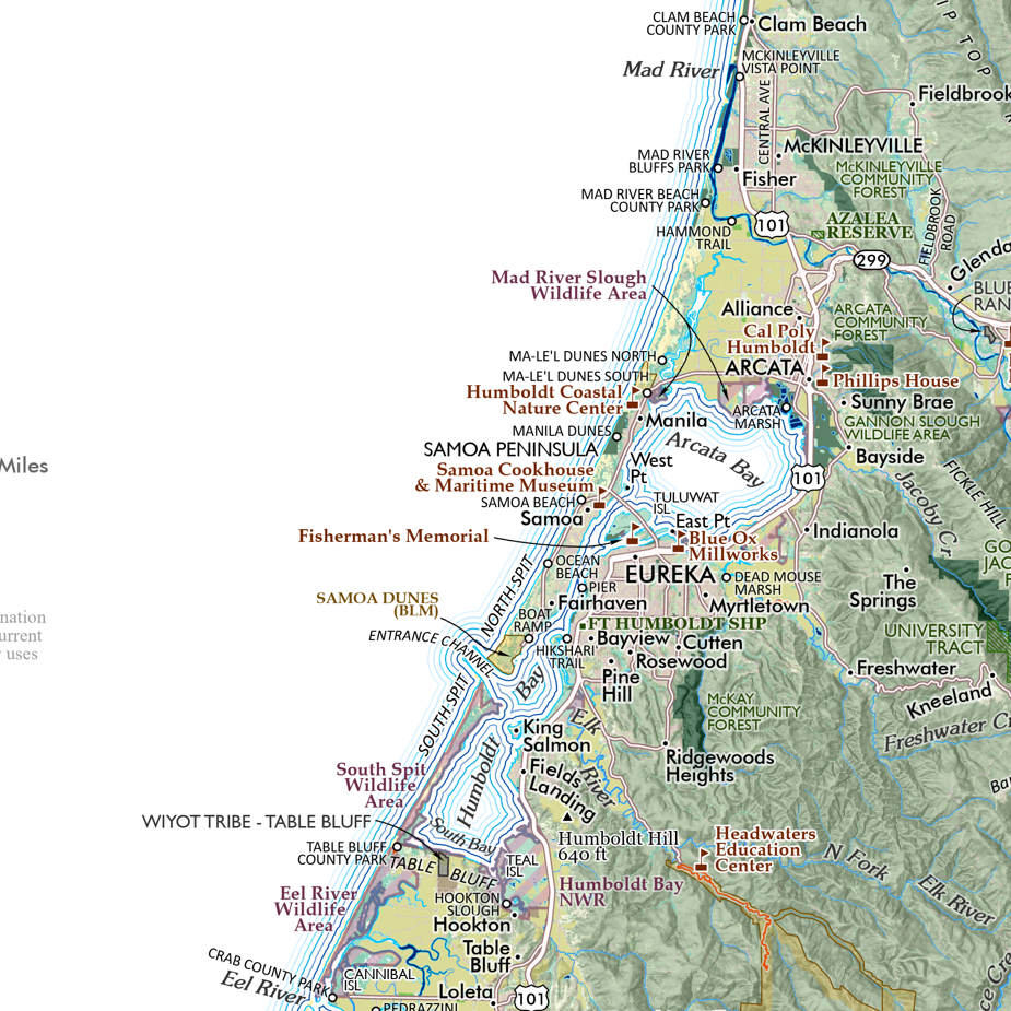
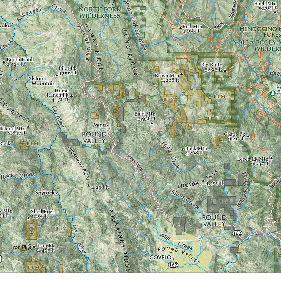
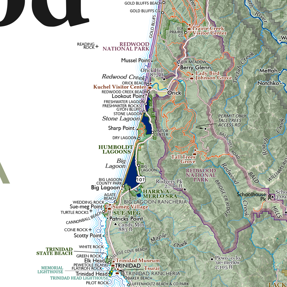
Detailed annotations, labeling, and map features include:
Populated place and locale names
Ferry routes (primary routes)
Prominent summits and high points
Waterbodies: inlets, bays, harbors, passages, lakes, reservoirs of notable size
Coastal landforms: capes, headlands, islands
Olympic National Park & other National Park/Preserve units within the map extent
Olympic National Forest
USFS designated wilderness
Washington State Trust Land
State Park/State Recreation Areas
County and local parks/recreation areas (only prominent local parks are labeled)
Reservations
U.S. Military Bases
Pacific Northwest Trail route
Interstate and major highways are labeled with shield numbers (local arterials and roads and not labeled due to the scale limitations)
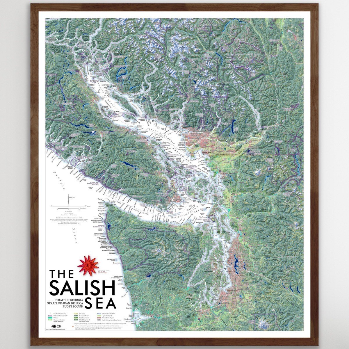
A broader overview map of the Salish Sea is also available.
TWO SIZES
• 28 inch x 20 inch flat wall map. 1:235,000 scale (i.e. more detail) Shipped tubed.
• 19 inch x 13 inch flat wall map. 1:350,000 scale (i.e. less detail). Packed and Shipped flat.
• 19 inch x 13 inch flat wall map. 1:350,000 scale COLOR YOUR OWN MAP version also available!
Puget Sound, Washington State. Regional overview and general reference map of the complex inlets, harbors and channels that comprise Washington State’s Puget Sound. The 28 x 20 inch version is highly detailed, the 13 x 19 version is generalized with less detail. (Please view the comparison detail image to see the difference -- all other images are of the detailed 28 x 20 inch map - TYPEFACES ARE THE SAME SIZE IN PRINT).
Detailed annotations, labeling, and map features include:
Populated place and locale names
Ferry routes (primary routes)
Prominent summits and high points
Waterbodies: inlets, bays, harbors, passages, lakes, reservoirs of notable size
Coastal landforms: capes, headlands, islands
Olympic National Park & other National Park/Preserve units within the map extent
Olympic National Forest
USFS designated wilderness
Washington State Trust Land
State Park/State Recreation Areas
County and local parks/recreation areas (only prominent local parks are labeled)
Reservations
U.S. Military Bases
Pacific Northwest Trail route
Interstate and major highways are labeled with shield numbers (local arterials and roads and not labeled due to the scale limitations)
A broader overview map of the Salish Sea is also available.

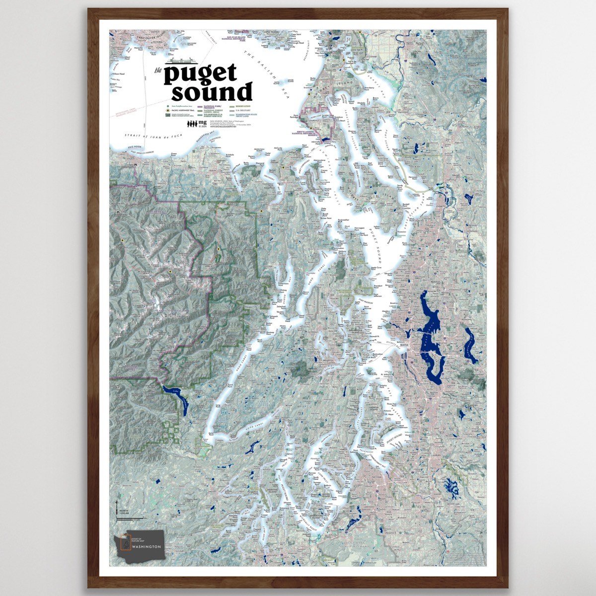 Image 1 of 13
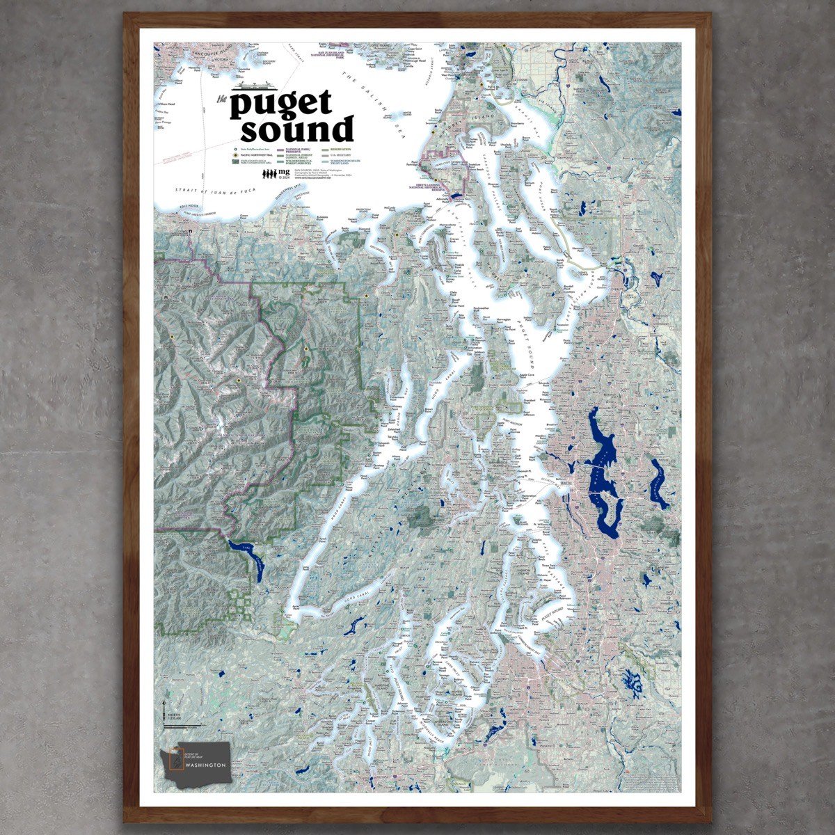 Image 2 of 13
 Image 3 of 13
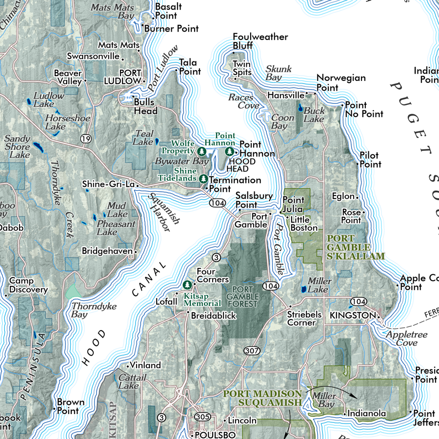 Image 4 of 13
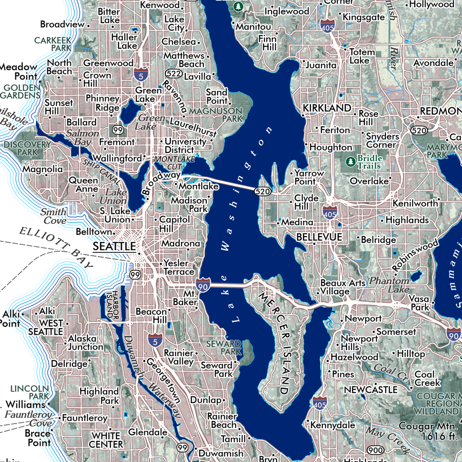 Image 5 of 13
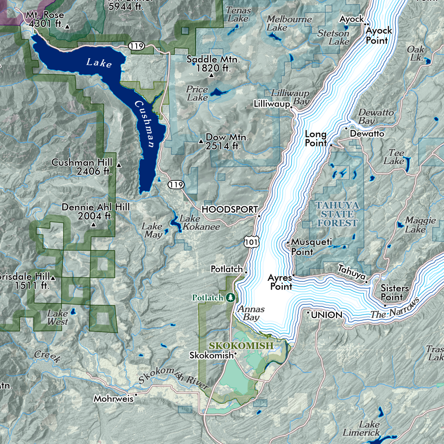 Image 6 of 13
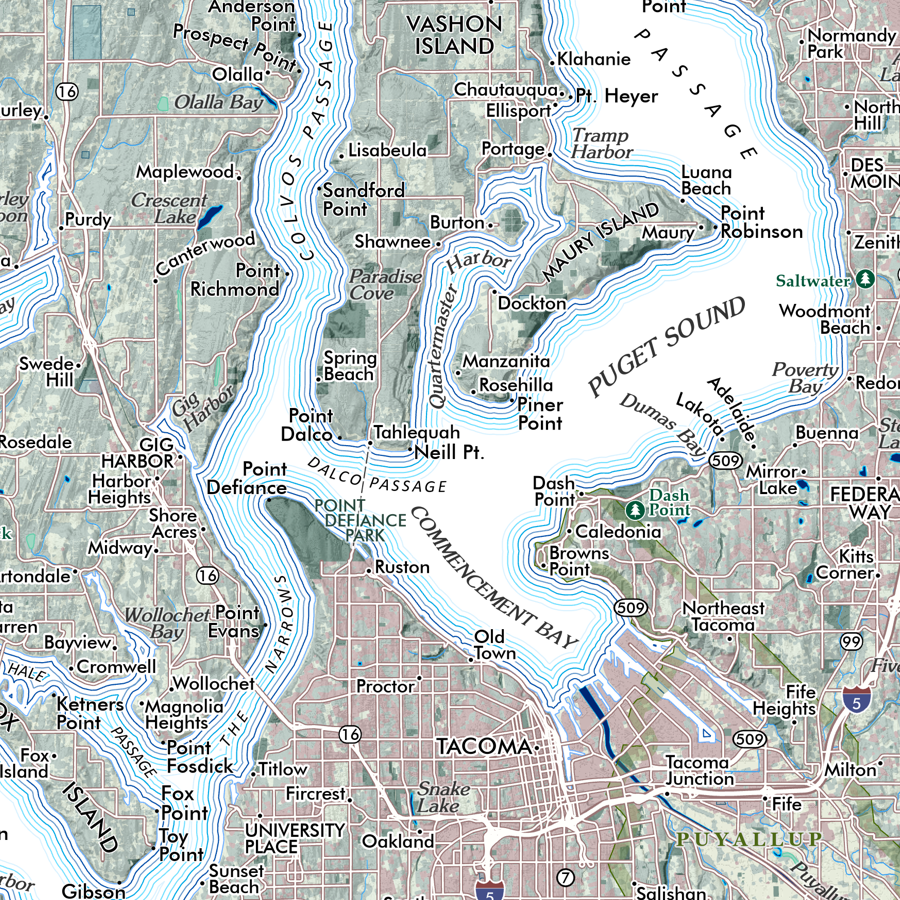 Image 7 of 13
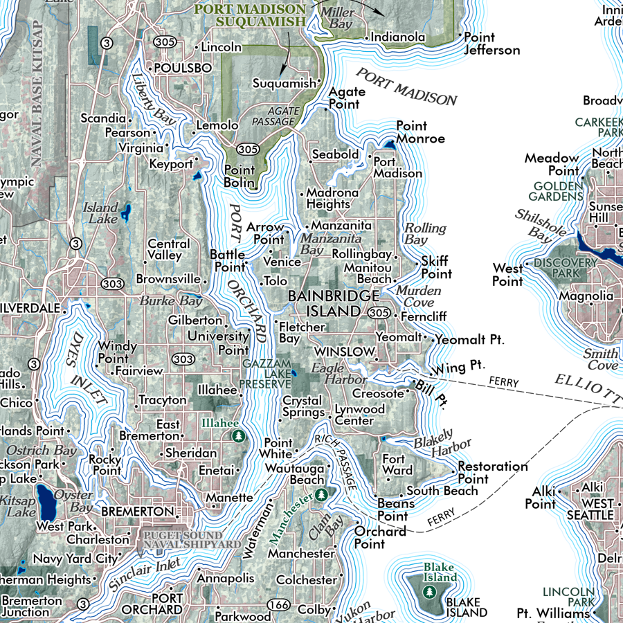 Image 8 of 13
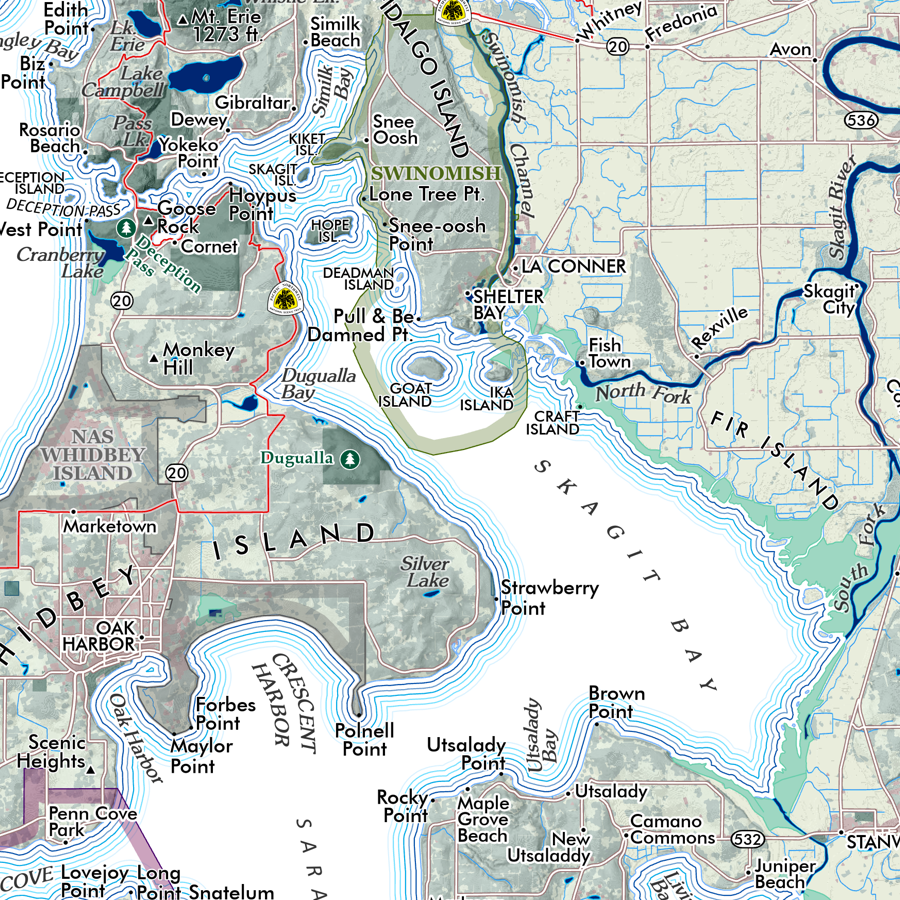 Image 9 of 13
 Image 10 of 13
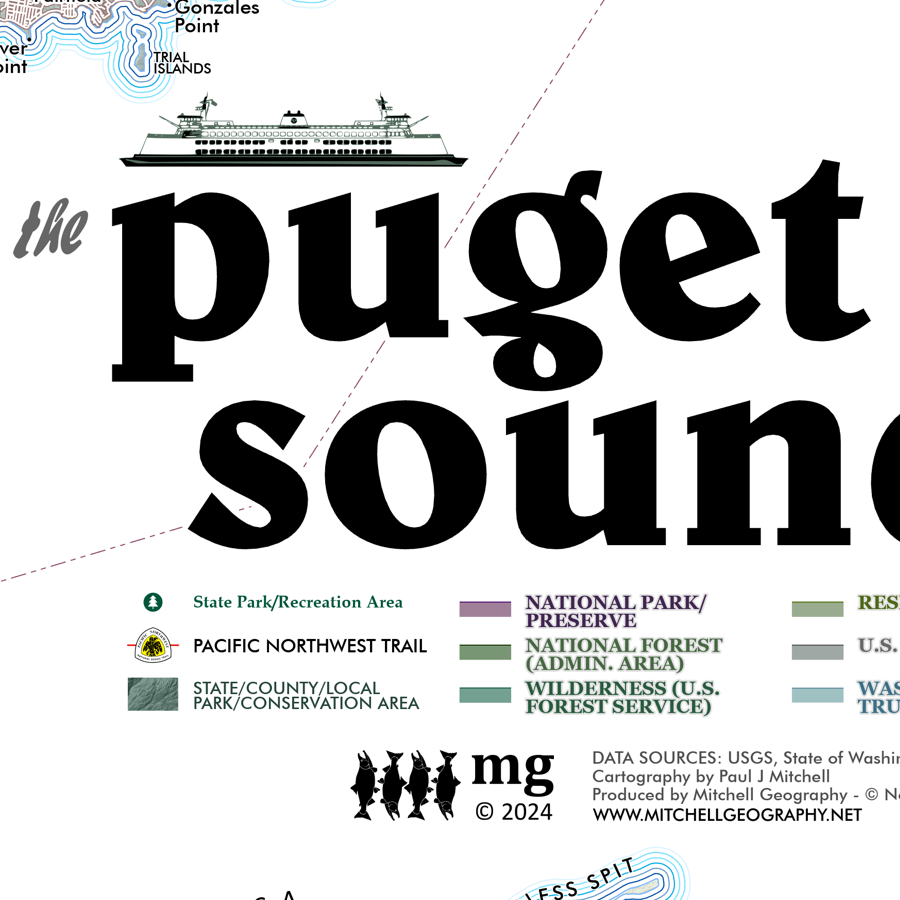 Image 11 of 13
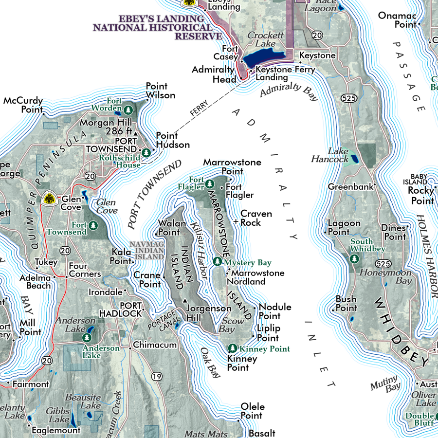 Image 12 of 13
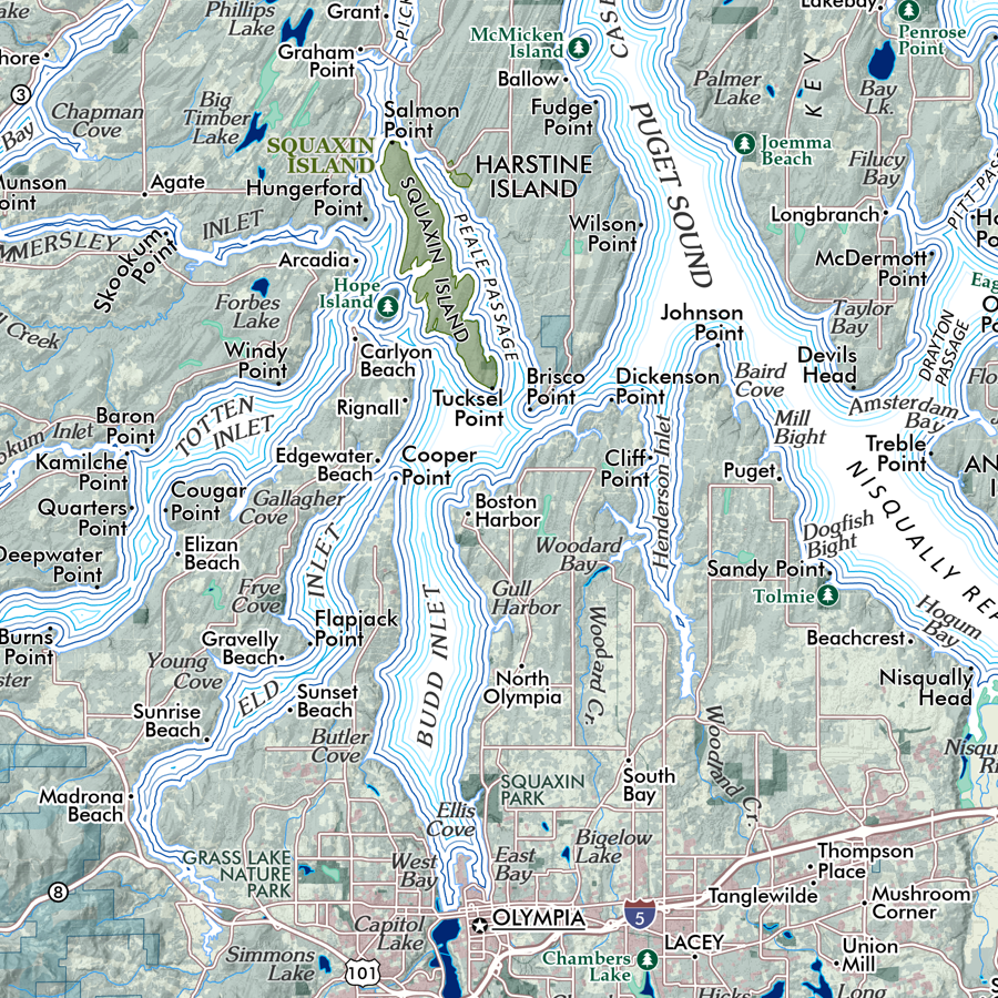 Image 13 of 13